You are here: Home > Network List > II - Global Seismograph Network (GSN - IRIS/IDA) Stations List
> Station WRAB Tennant Creek, NT, Australia > Earthquake Result Viewer
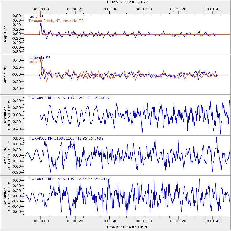
WRAB Tennant Creek, NT, Australia - Earthquake Result Viewer
*The percent match for this event was below the threshold and hence no stack was calculated.
| Earthquake location: |
Mindanao, Philippines |
| Earthquake latitude/longitude: |
9.8/126.4 |
| Earthquake time(UTC): |
1996/11/05 (310) 12:29:45 GMT |
| Earthquake Depth: |
33 km |
| Earthquake Magnitude: |
5.7 MB, 5.5 MS, 5.9 UNKNOWN, 5.8 MW |
| Earthquake Catalog/Contributor: |
WHDF/NEIC |
|
| Network: |
II Global Seismograph Network (GSN - IRIS/IDA) |
| Station: |
WRAB Tennant Creek, NT, Australia |
| Lat/Lon: |
19.93 S/134.36 E |
| Elevation: |
366 m |
|
| Distance: |
30.5 deg |
| Az: |
165.066 deg |
| Baz: |
344.335 deg |
| Ray Param: |
$rayparam |
*The percent match for this event was below the threshold and hence was not used in the summary stack. |
|
| Radial Match: |
67.03774 % |
| Radial Bump: |
400 |
| Transverse Match: |
54.74145 % |
| Transverse Bump: |
400 |
| SOD ConfigId: |
4480 |
| Insert Time: |
2010-03-01 23:29:43.798 +0000 |
| GWidth: |
2.5 |
| Max Bumps: |
400 |
| Tol: |
0.001 |
|
Signal To Noise
| Channel | StoN | STA | LTA |
| II:WRAB:00:BHN:19961105T12:35:25.969Z | 2.0044968 | 3.726035E-7 | 1.8588379E-7 |
| II:WRAB:00:BHE:19961105T12:35:25.958014Z | 1.8503301 | 1.968109E-7 | 1.06365285E-7 |
| II:WRAB:00:BHZ:19961105T12:35:25.952002Z | 1.0857671 | 1.695859E-7 | 1.5618994E-7 |
| Arrivals |
| Ps | |
| PpPs | |
| PsPs/PpSs | |


