You are here: Home > Network List > II - Global Seismograph Network (GSN - IRIS/IDA) Stations List
> Station WRAB Tennant Creek, NT, Australia > Earthquake Result Viewer
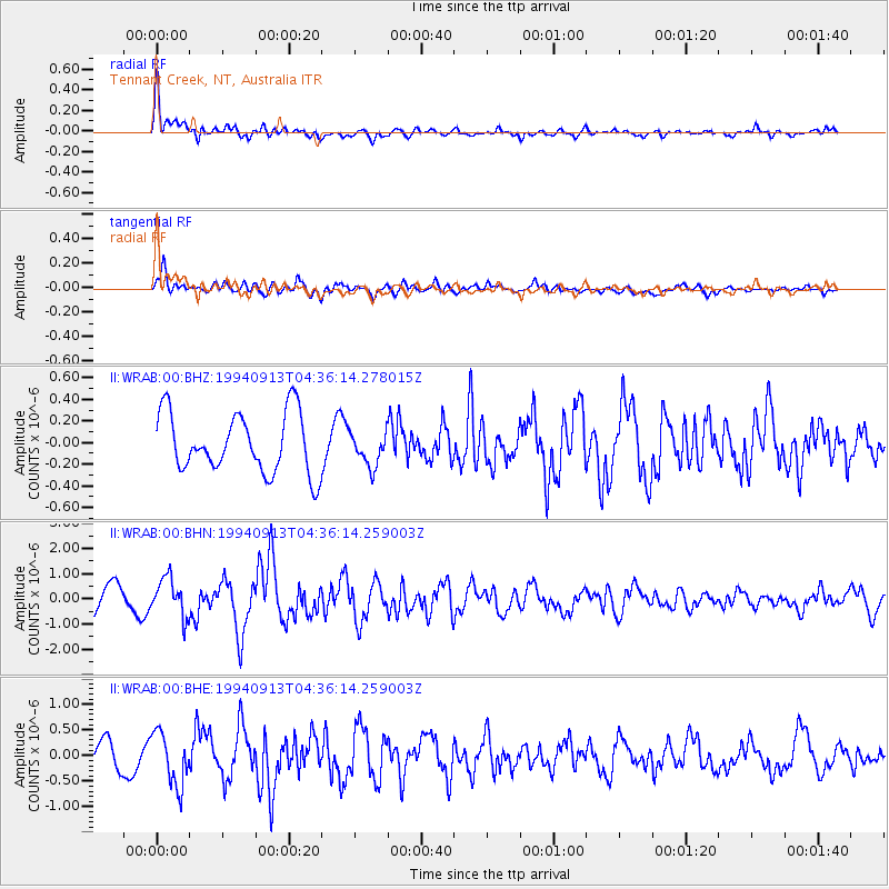
WRAB Tennant Creek, NT, Australia - Earthquake Result Viewer
*The percent match for this event was below the threshold and hence no stack was calculated.
| Earthquake location: |
Ryukyu Islands, Japan |
| Earthquake latitude/longitude: |
29.3/129.9 |
| Earthquake time(UTC): |
1994/09/13 (256) 04:28:01 GMT |
| Earthquake Depth: |
37 km |
| Earthquake Magnitude: |
5.8 MB, 6.3 MS, 6.2 UNKNOWN, 6.1 MW |
| Earthquake Catalog/Contributor: |
WHDF/NEIC |
|
| Network: |
II Global Seismograph Network (GSN - IRIS/IDA) |
| Station: |
WRAB Tennant Creek, NT, Australia |
| Lat/Lon: |
19.93 S/134.36 E |
| Elevation: |
366 m |
|
| Distance: |
49.1 deg |
| Az: |
174.393 deg |
| Baz: |
354.794 deg |
| Ray Param: |
$rayparam |
*The percent match for this event was below the threshold and hence was not used in the summary stack. |
|
| Radial Match: |
68.37758 % |
| Radial Bump: |
400 |
| Transverse Match: |
75.72252 % |
| Transverse Bump: |
400 |
| SOD ConfigId: |
4480 |
| Insert Time: |
2010-03-01 23:29:45.182 +0000 |
| GWidth: |
2.5 |
| Max Bumps: |
400 |
| Tol: |
0.001 |
|
Signal To Noise
| Channel | StoN | STA | LTA |
| II:WRAB:00:BHN:19940913T04:36:14.259003Z | 2.0739458 | 7.573045E-7 | 3.6515155E-7 |
| II:WRAB:00:BHE:19940913T04:36:14.259003Z | 2.709515 | 5.098917E-7 | 1.8818561E-7 |
| II:WRAB:00:BHZ:19940913T04:36:14.278015Z | 0.57976407 | 1.5912732E-7 | 2.7446913E-7 |
| Arrivals |
| Ps | |
| PpPs | |
| PsPs/PpSs | |


