You are here: Home > Network List > II - Global Seismograph Network (GSN - IRIS/IDA) Stations List
> Station WRAB Tennant Creek, NT, Australia > Earthquake Result Viewer
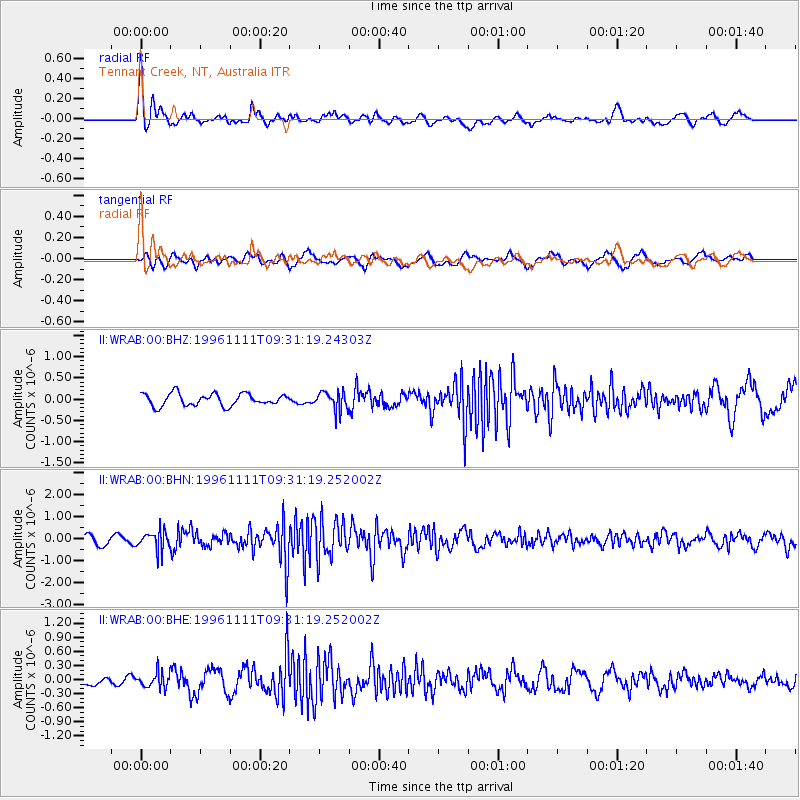
WRAB Tennant Creek, NT, Australia - Earthquake Result Viewer
*The percent match for this event was below the threshold and hence no stack was calculated.
| Earthquake location: |
Myanmar |
| Earthquake latitude/longitude: |
19.3/95.0 |
| Earthquake time(UTC): |
1996/11/11 (316) 09:22:27 GMT |
| Earthquake Depth: |
80 km |
| Earthquake Magnitude: |
5.6 MB, 5.4 MS, 6.0 UNKNOWN, 5.9 MW |
| Earthquake Catalog/Contributor: |
WHDF/NEIC |
|
| Network: |
II Global Seismograph Network (GSN - IRIS/IDA) |
| Station: |
WRAB Tennant Creek, NT, Australia |
| Lat/Lon: |
19.93 S/134.36 E |
| Elevation: |
366 m |
|
| Distance: |
54.9 deg |
| Az: |
133.163 deg |
| Baz: |
312.936 deg |
| Ray Param: |
$rayparam |
*The percent match for this event was below the threshold and hence was not used in the summary stack. |
|
| Radial Match: |
67.39439 % |
| Radial Bump: |
400 |
| Transverse Match: |
64.08639 % |
| Transverse Bump: |
400 |
| SOD ConfigId: |
4480 |
| Insert Time: |
2010-03-01 23:29:51.591 +0000 |
| GWidth: |
2.5 |
| Max Bumps: |
400 |
| Tol: |
0.001 |
|
Signal To Noise
| Channel | StoN | STA | LTA |
| II:WRAB:00:BHN:19961111T09:31:19.252002Z | 1.8559896 | 4.2243013E-7 | 2.276037E-7 |
| II:WRAB:00:BHE:19961111T09:31:19.252002Z | 0.98812735 | 1.579649E-7 | 1.5986289E-7 |
| II:WRAB:00:BHZ:19961111T09:31:19.24303Z | 1.5440251 | 2.194301E-7 | 1.4211564E-7 |
| Arrivals |
| Ps | |
| PpPs | |
| PsPs/PpSs | |


