You are here: Home > Network List > II - Global Seismograph Network (GSN - IRIS/IDA) Stations List
> Station WRAB Tennant Creek, NT, Australia > Earthquake Result Viewer
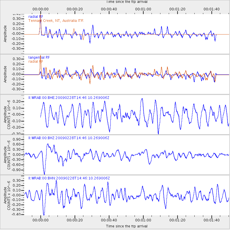
WRAB Tennant Creek, NT, Australia - Earthquake Result Viewer
*The percent match for this event was below the threshold and hence no stack was calculated.
| Earthquake location: |
South Sandwich Islands Region |
| Earthquake latitude/longitude: |
-60.5/-24.8 |
| Earthquake time(UTC): |
2009/02/28 (059) 14:33:06 GMT |
| Earthquake Depth: |
15 km |
| Earthquake Magnitude: |
6.1 MB, 6.1 MS, 6.3 MW, 6.3 MW |
| Earthquake Catalog/Contributor: |
WHDF/NEIC |
|
| Network: |
II Global Seismograph Network (GSN - IRIS/IDA) |
| Station: |
WRAB Tennant Creek, NT, Australia |
| Lat/Lon: |
19.93 S/134.36 E |
| Elevation: |
366 m |
|
| Distance: |
98.1 deg |
| Az: |
160.238 deg |
| Baz: |
190.238 deg |
| Ray Param: |
$rayparam |
*The percent match for this event was below the threshold and hence was not used in the summary stack. |
|
| Radial Match: |
62.172333 % |
| Radial Bump: |
400 |
| Transverse Match: |
64.52824 % |
| Transverse Bump: |
400 |
| SOD ConfigId: |
2658 |
| Insert Time: |
2010-03-01 23:29:54.173 +0000 |
| GWidth: |
2.5 |
| Max Bumps: |
400 |
| Tol: |
0.001 |
|
Signal To Noise
| Channel | StoN | STA | LTA |
| II:WRAB:00:BHZ:20090228T14:46:10.269006Z | 5.8357506 | 5.541337E-7 | 9.4955006E-8 |
| II:WRAB:00:BHN:20090228T14:46:10.269006Z | 2.0819964 | 2.0526826E-7 | 9.859203E-8 |
| II:WRAB:00:BHE:20090228T14:46:10.269006Z | 1.0306345 | 1.1250849E-7 | 1.0916429E-7 |
| Arrivals |
| Ps | |
| PpPs | |
| PsPs/PpSs | |


