You are here: Home > Network List > II - Global Seismograph Network (GSN - IRIS/IDA) Stations List
> Station WRAB Tennant Creek, NT, Australia > Earthquake Result Viewer
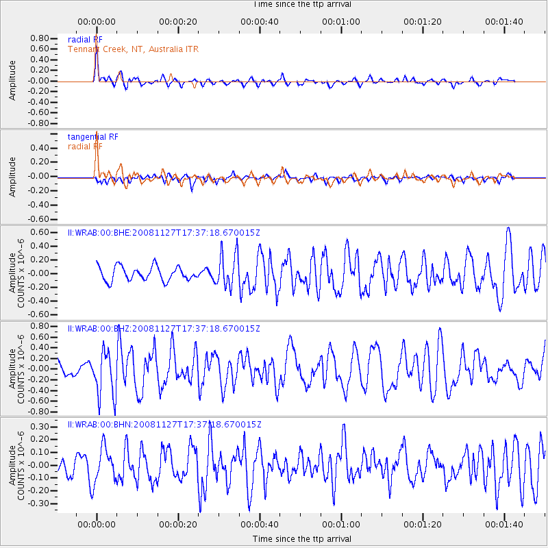
WRAB Tennant Creek, NT, Australia - Earthquake Result Viewer
*The percent match for this event was below the threshold and hence no stack was calculated.
| Earthquake location: |
Vanuatu Islands |
| Earthquake latitude/longitude: |
-17.8/167.6 |
| Earthquake time(UTC): |
2008/11/27 (332) 17:31:27 GMT |
| Earthquake Depth: |
10 km |
| Earthquake Magnitude: |
5.5 MB, 5.3 MS, 5.5 MW |
| Earthquake Catalog/Contributor: |
WHDF/NEIC |
|
| Network: |
II Global Seismograph Network (GSN - IRIS/IDA) |
| Station: |
WRAB Tennant Creek, NT, Australia |
| Lat/Lon: |
19.93 S/134.36 E |
| Elevation: |
366 m |
|
| Distance: |
31.5 deg |
| Az: |
260.772 deg |
| Baz: |
91.731 deg |
| Ray Param: |
$rayparam |
*The percent match for this event was below the threshold and hence was not used in the summary stack. |
|
| Radial Match: |
74.06258 % |
| Radial Bump: |
363 |
| Transverse Match: |
55.94661 % |
| Transverse Bump: |
400 |
| SOD ConfigId: |
2658 |
| Insert Time: |
2010-03-01 23:29:55.703 +0000 |
| GWidth: |
2.5 |
| Max Bumps: |
400 |
| Tol: |
0.001 |
|
Signal To Noise
| Channel | StoN | STA | LTA |
| II:WRAB:00:BHZ:20081127T17:37:18.670015Z | 2.6145918 | 4.248609E-7 | 1.6249608E-7 |
| II:WRAB:00:BHN:20081127T17:37:18.670015Z | 1.2595577 | 1.3570741E-7 | 1.0774211E-7 |
| II:WRAB:00:BHE:20081127T17:37:18.670015Z | 2.4016633 | 2.4625845E-7 | 1.02536625E-7 |
| Arrivals |
| Ps | |
| PpPs | |
| PsPs/PpSs | |


