You are here: Home > Network List > II - Global Seismograph Network (GSN - IRIS/IDA) Stations List
> Station WRAB Tennant Creek, NT, Australia > Earthquake Result Viewer
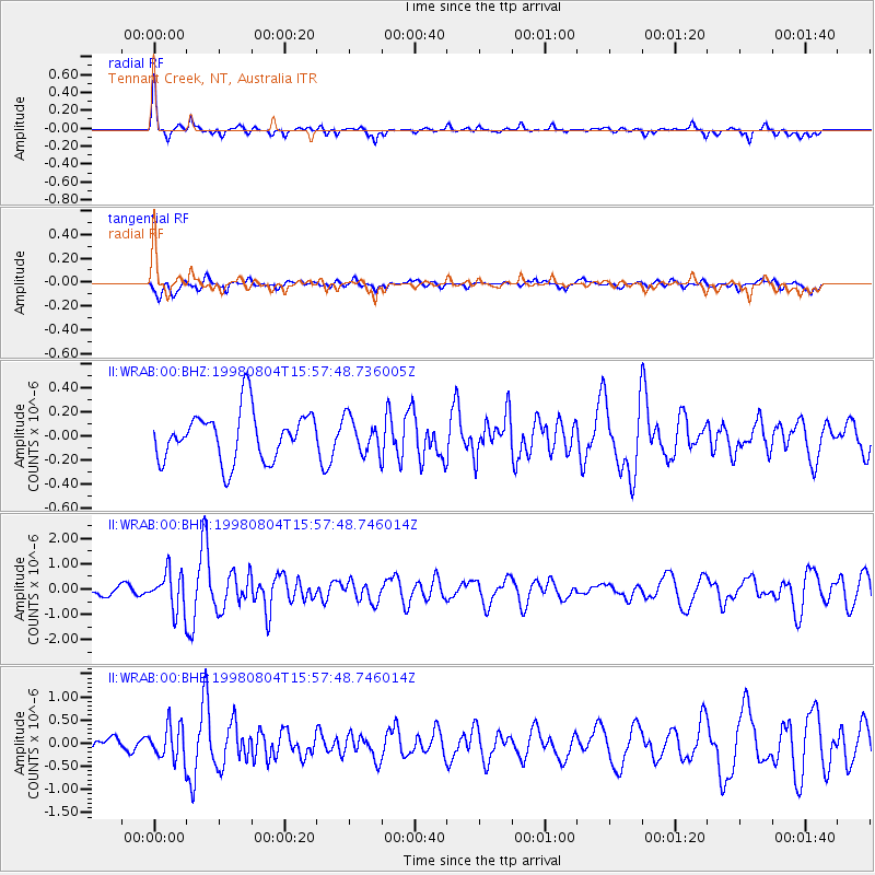
WRAB Tennant Creek, NT, Australia - Earthquake Result Viewer
*The percent match for this event was below the threshold and hence no stack was calculated.
| Earthquake location: |
West Of Macquarie Island |
| Earthquake latitude/longitude: |
-56.7/147.4 |
| Earthquake time(UTC): |
1998/08/04 (216) 15:51:01 GMT |
| Earthquake Depth: |
10 km |
| Earthquake Magnitude: |
5.5 MS, 5.3 MB |
| Earthquake Catalog/Contributor: |
WHDF/NEIC |
|
| Network: |
II Global Seismograph Network (GSN - IRIS/IDA) |
| Station: |
WRAB Tennant Creek, NT, Australia |
| Lat/Lon: |
19.93 S/134.36 E |
| Elevation: |
366 m |
|
| Distance: |
38.0 deg |
| Az: |
339.758 deg |
| Baz: |
168.289 deg |
| Ray Param: |
$rayparam |
*The percent match for this event was below the threshold and hence was not used in the summary stack. |
|
| Radial Match: |
78.83964 % |
| Radial Bump: |
259 |
| Transverse Match: |
56.485973 % |
| Transverse Bump: |
400 |
| SOD ConfigId: |
4480 |
| Insert Time: |
2010-03-01 23:30:00.227 +0000 |
| GWidth: |
2.5 |
| Max Bumps: |
400 |
| Tol: |
0.001 |
|
Signal To Noise
| Channel | StoN | STA | LTA |
| II:WRAB:00:BHN:19980804T15:57:48.746014Z | 2.516513 | 7.665142E-7 | 3.0459373E-7 |
| II:WRAB:00:BHE:19980804T15:57:48.746014Z | 1.7818708 | 3.7640584E-7 | 2.1124193E-7 |
| II:WRAB:00:BHZ:19980804T15:57:48.736005Z | 0.70735383 | 1.4402619E-7 | 2.0361266E-7 |
| Arrivals |
| Ps | |
| PpPs | |
| PsPs/PpSs | |


