You are here: Home > Network List > II - Global Seismograph Network (GSN - IRIS/IDA) Stations List
> Station WRAB Tennant Creek, NT, Australia > Earthquake Result Viewer
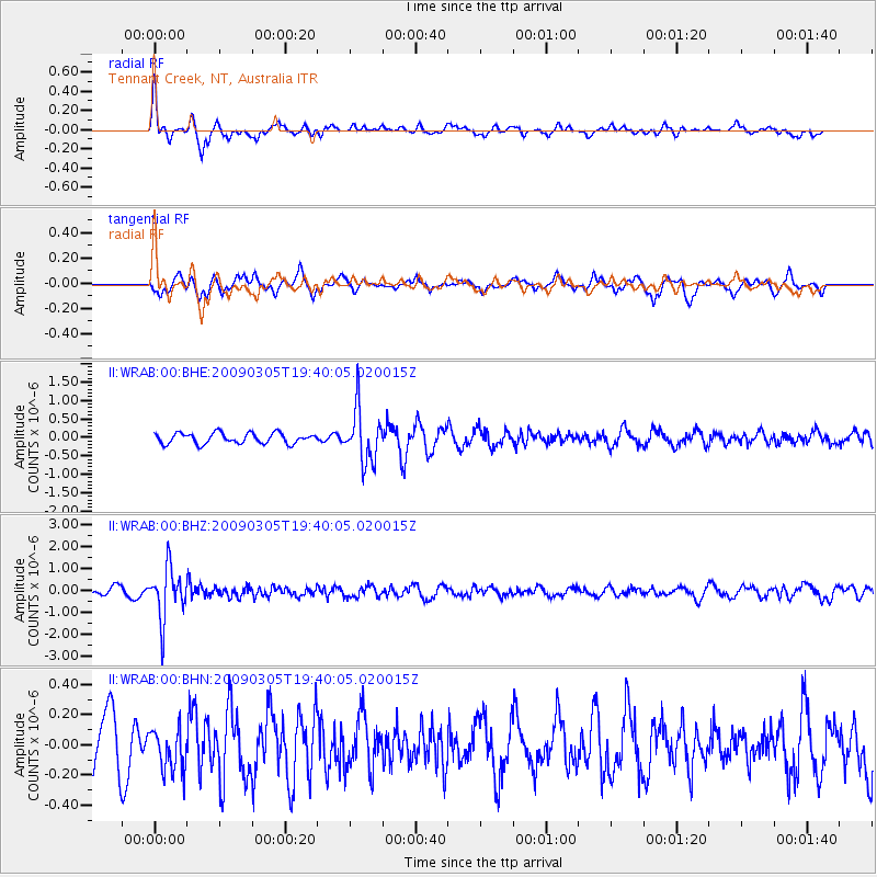
WRAB Tennant Creek, NT, Australia - Earthquake Result Viewer
*The percent match for this event was below the threshold and hence no stack was calculated.
| Earthquake location: |
Fiji Islands Region |
| Earthquake latitude/longitude: |
-17.5/-179.1 |
| Earthquake time(UTC): |
2009/03/05 (064) 19:33:14 GMT |
| Earthquake Depth: |
532 km |
| Earthquake Magnitude: |
5.9 MW, 5.4 MB, 5.8 MW |
| Earthquake Catalog/Contributor: |
WHDF/NEIC |
|
| Network: |
II Global Seismograph Network (GSN - IRIS/IDA) |
| Station: |
WRAB Tennant Creek, NT, Australia |
| Lat/Lon: |
19.93 S/134.36 E |
| Elevation: |
366 m |
|
| Distance: |
44.1 deg |
| Az: |
259.228 deg |
| Baz: |
94.874 deg |
| Ray Param: |
$rayparam |
*The percent match for this event was below the threshold and hence was not used in the summary stack. |
|
| Radial Match: |
62.01449 % |
| Radial Bump: |
278 |
| Transverse Match: |
67.789566 % |
| Transverse Bump: |
383 |
| SOD ConfigId: |
2658 |
| Insert Time: |
2010-03-01 23:30:06.021 +0000 |
| GWidth: |
2.5 |
| Max Bumps: |
400 |
| Tol: |
0.001 |
|
Signal To Noise
| Channel | StoN | STA | LTA |
| II:WRAB:00:BHZ:20090305T19:40:05.020015Z | 6.5253487 | 1.168686E-6 | 1.7909939E-7 |
| II:WRAB:00:BHN:20090305T19:40:05.020015Z | 0.6880719 | 1.394283E-7 | 2.0263622E-7 |
| II:WRAB:00:BHE:20090305T19:40:05.020015Z | 5.0519347 | 7.2324576E-7 | 1.4316214E-7 |
| Arrivals |
| Ps | |
| PpPs | |
| PsPs/PpSs | |


