You are here: Home > Network List > II - Global Seismograph Network (GSN - IRIS/IDA) Stations List
> Station WRAB Tennant Creek, NT, Australia > Earthquake Result Viewer
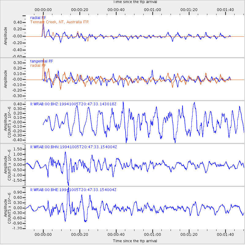
WRAB Tennant Creek, NT, Australia - Earthquake Result Viewer
*The percent match for this event was below the threshold and hence no stack was calculated.
| Earthquake location: |
Kuril Islands |
| Earthquake latitude/longitude: |
43.5/147.5 |
| Earthquake time(UTC): |
1994/10/05 (278) 20:37:31 GMT |
| Earthquake Depth: |
33 km |
| Earthquake Magnitude: |
5.7 MB, 5.9 MS, 5.9 UNKNOWN, 5.9 MW |
| Earthquake Catalog/Contributor: |
WHDF/NEIC |
|
| Network: |
II Global Seismograph Network (GSN - IRIS/IDA) |
| Station: |
WRAB Tennant Creek, NT, Australia |
| Lat/Lon: |
19.93 S/134.36 E |
| Elevation: |
366 m |
|
| Distance: |
64.3 deg |
| Az: |
193.691 deg |
| Baz: |
10.541 deg |
| Ray Param: |
$rayparam |
*The percent match for this event was below the threshold and hence was not used in the summary stack. |
|
| Radial Match: |
57.62773 % |
| Radial Bump: |
400 |
| Transverse Match: |
57.22497 % |
| Transverse Bump: |
328 |
| SOD ConfigId: |
4480 |
| Insert Time: |
2010-03-01 23:30:13.366 +0000 |
| GWidth: |
2.5 |
| Max Bumps: |
400 |
| Tol: |
0.001 |
|
Signal To Noise
| Channel | StoN | STA | LTA |
| II:WRAB:00:BHN:19941005T20:47:33.154004Z | 3.5933814 | 4.375038E-7 | 1.2175268E-7 |
| II:WRAB:00:BHE:19941005T20:47:33.154004Z | 2.1694922 | 2.0800445E-7 | 9.587701E-8 |
| II:WRAB:00:BHZ:19941005T20:47:33.143018Z | 1.2740588 | 2.0693832E-7 | 1.6242447E-7 |
| Arrivals |
| Ps | |
| PpPs | |
| PsPs/PpSs | |


