You are here: Home > Network List > II - Global Seismograph Network (GSN - IRIS/IDA) Stations List
> Station WRAB Tennant Creek, NT, Australia > Earthquake Result Viewer
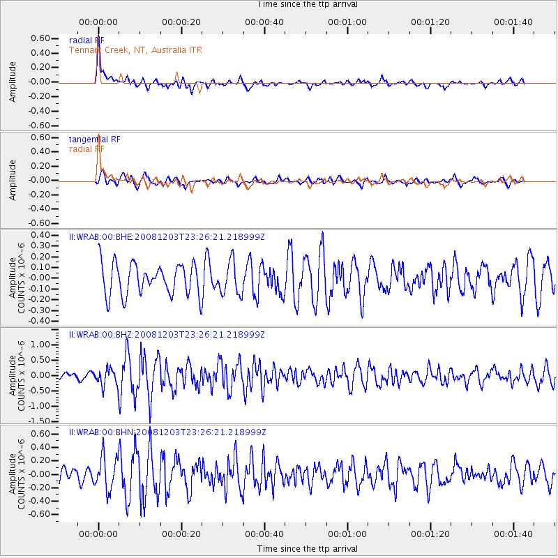
WRAB Tennant Creek, NT, Australia - Earthquake Result Viewer
*The percent match for this event was below the threshold and hence no stack was calculated.
| Earthquake location: |
Near East Coast Of Honshu, Japan |
| Earthquake latitude/longitude: |
38.6/142.9 |
| Earthquake time(UTC): |
2008/12/03 (338) 23:16:54 GMT |
| Earthquake Depth: |
14 km |
| Earthquake Magnitude: |
5.6 MB, 5.5 MS, 5.8 MW, 5.8 MW |
| Earthquake Catalog/Contributor: |
WHDF/NEIC |
|
| Network: |
II Global Seismograph Network (GSN - IRIS/IDA) |
| Station: |
WRAB Tennant Creek, NT, Australia |
| Lat/Lon: |
19.93 S/134.36 E |
| Elevation: |
366 m |
|
| Distance: |
58.8 deg |
| Az: |
189.38 deg |
| Baz: |
7.803 deg |
| Ray Param: |
$rayparam |
*The percent match for this event was below the threshold and hence was not used in the summary stack. |
|
| Radial Match: |
70.58224 % |
| Radial Bump: |
400 |
| Transverse Match: |
54.377357 % |
| Transverse Bump: |
400 |
| SOD ConfigId: |
2658 |
| Insert Time: |
2010-03-01 23:30:17.926 +0000 |
| GWidth: |
2.5 |
| Max Bumps: |
400 |
| Tol: |
0.001 |
|
Signal To Noise
| Channel | StoN | STA | LTA |
| II:WRAB:00:BHZ:20081203T23:26:21.218999Z | 2.2826612 | 2.794177E-7 | 1.2240874E-7 |
| II:WRAB:00:BHN:20081203T23:26:21.218999Z | 2.979071 | 2.5269034E-7 | 8.482186E-8 |
| II:WRAB:00:BHE:20081203T23:26:21.218999Z | 1.0707237 | 1.5633763E-7 | 1.4601119E-7 |
| Arrivals |
| Ps | |
| PpPs | |
| PsPs/PpSs | |


