You are here: Home > Network List > TA - USArray Transportable Network (new EarthScope stations) Stations List
> Station W41B Gary Mavity, Velonia, AR, USA > Earthquake Result Viewer
W41B Gary Mavity, Velonia, AR, USA - Earthquake Result Viewer
*The percent match for this event was below the threshold and hence no stack was calculated.
| Earthquake location: |
Rat Islands, Aleutian Islands |
| Earthquake latitude/longitude: |
52.0/178.4 |
| Earthquake time(UTC): |
2014/06/24 (175) 00:52:28 GMT |
| Earthquake Depth: |
103 km |
| Earthquake Magnitude: |
5.7 MB |
| Earthquake Catalog/Contributor: |
NEIC PDE/NEIC COMCAT |
|
| Network: |
TA USArray Transportable Network (new EarthScope stations) |
| Station: |
W41B Gary Mavity, Velonia, AR, USA |
| Lat/Lon: |
35.17 N/92.25 W |
| Elevation: |
95 m |
|
| Distance: |
62.8 deg |
| Az: |
67.044 deg |
| Baz: |
315.973 deg |
| Ray Param: |
$rayparam |
*The percent match for this event was below the threshold and hence was not used in the summary stack. |
|
| Radial Match: |
59.65407 % |
| Radial Bump: |
400 |
| Transverse Match: |
52.621685 % |
| Transverse Bump: |
371 |
| SOD ConfigId: |
739768 |
| Insert Time: |
2014-07-08 01:45:19.510 +0000 |
| GWidth: |
2.5 |
| Max Bumps: |
400 |
| Tol: |
0.001 |
|
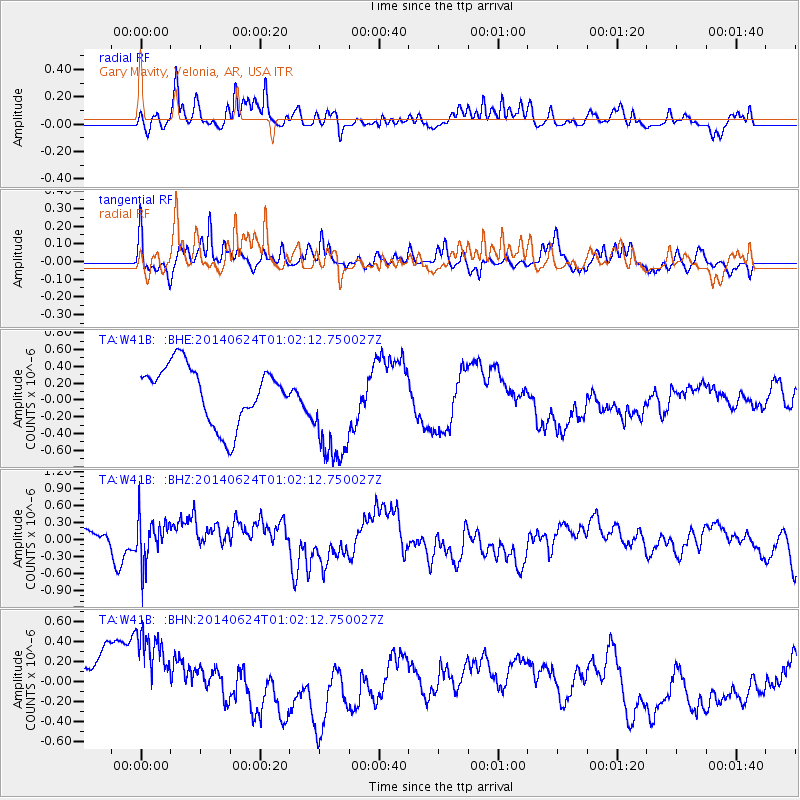
Signal To Noise
| Channel | StoN | STA | LTA |
| TA:W41B: :BHZ:20140624T01:02:12.750027Z | 1.4364413 | 3.955363E-7 | 2.7535847E-7 |
| TA:W41B: :BHN:20140624T01:02:12.750027Z | 1.9542142 | 5.9765347E-7 | 3.0582802E-7 |
| TA:W41B: :BHE:20140624T01:02:12.750027Z | 1.9518813 | 6.651451E-7 | 3.407713E-7 |
| Arrivals |
| Ps | |
| PpPs | |
| PsPs/PpSs | |


