You are here: Home > Network List > US - United States National Seismic Network Stations List
> Station AMTX Amarillo, Texas, USA > Earthquake Result Viewer
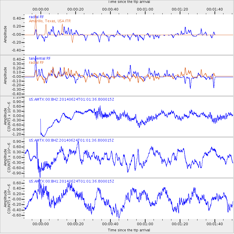
AMTX Amarillo, Texas, USA - Earthquake Result Viewer
*The percent match for this event was below the threshold and hence no stack was calculated.
| Earthquake location: |
Rat Islands, Aleutian Islands |
| Earthquake latitude/longitude: |
52.0/178.4 |
| Earthquake time(UTC): |
2014/06/24 (175) 00:52:28 GMT |
| Earthquake Depth: |
103 km |
| Earthquake Magnitude: |
5.7 MB |
| Earthquake Catalog/Contributor: |
NEIC PDE/NEIC COMCAT |
|
| Network: |
US United States National Seismic Network |
| Station: |
AMTX Amarillo, Texas, USA |
| Lat/Lon: |
34.53 N/101.41 W |
| Elevation: |
1010 m |
|
| Distance: |
57.9 deg |
| Az: |
73.69 deg |
| Baz: |
314.044 deg |
| Ray Param: |
$rayparam |
*The percent match for this event was below the threshold and hence was not used in the summary stack. |
|
| Radial Match: |
61.5666 % |
| Radial Bump: |
359 |
| Transverse Match: |
55.848755 % |
| Transverse Bump: |
339 |
| SOD ConfigId: |
739768 |
| Insert Time: |
2014-07-08 01:47:01.638 +0000 |
| GWidth: |
2.5 |
| Max Bumps: |
400 |
| Tol: |
0.001 |
|
Signal To Noise
| Channel | StoN | STA | LTA |
| US:AMTX:00:BHZ:20140624T01:01:36.800015Z | 2.1425173 | 5.890905E-7 | 2.749525E-7 |
| US:AMTX:00:BH1:20140624T01:01:36.800015Z | 4.2746563 | 5.974148E-7 | 1.3975738E-7 |
| US:AMTX:00:BH2:20140624T01:01:36.800015Z | 0.84261596 | 3.213883E-7 | 3.8141732E-7 |
| Arrivals |
| Ps | |
| PpPs | |
| PsPs/PpSs | |


