You are here: Home > Network List > II - Global Seismograph Network (GSN - IRIS/IDA) Stations List
> Station WRAB Tennant Creek, NT, Australia > Earthquake Result Viewer
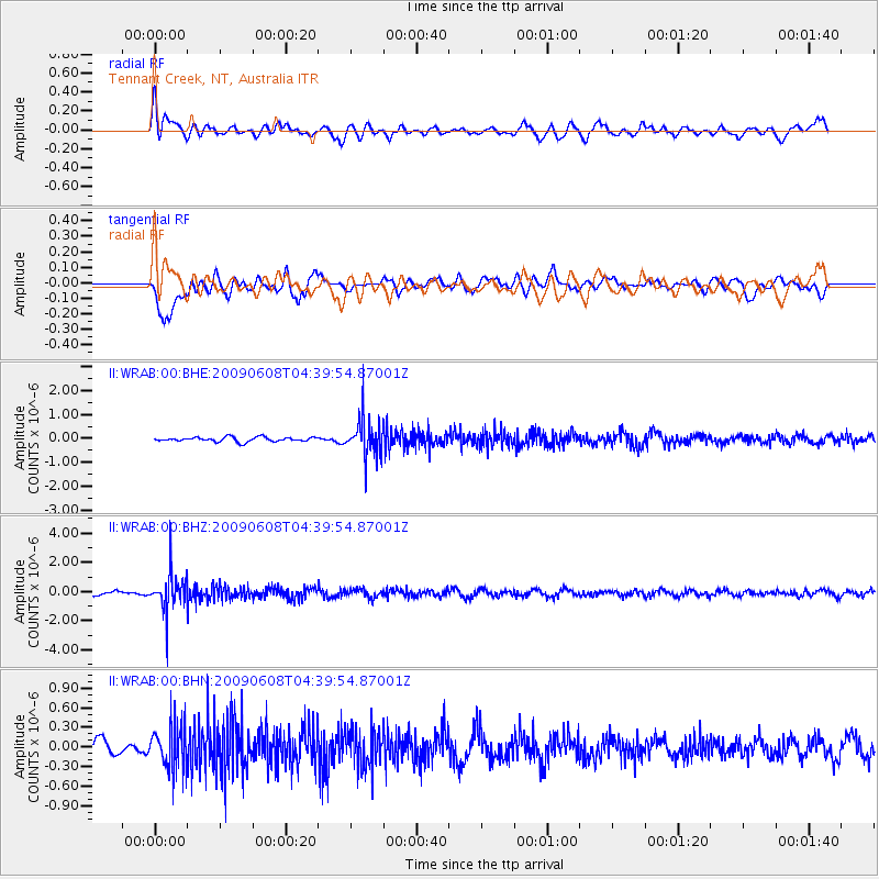
WRAB Tennant Creek, NT, Australia - Earthquake Result Viewer
*The percent match for this event was below the threshold and hence no stack was calculated.
| Earthquake location: |
South Of Fiji Islands |
| Earthquake latitude/longitude: |
-22.2/-179.6 |
| Earthquake time(UTC): |
2009/06/08 (159) 04:33:19 GMT |
| Earthquake Depth: |
612 km |
| Earthquake Magnitude: |
5.5 MW, 5.2 MB |
| Earthquake Catalog/Contributor: |
WHDF/NEIC |
|
| Network: |
II Global Seismograph Network (GSN - IRIS/IDA) |
| Station: |
WRAB Tennant Creek, NT, Australia |
| Lat/Lon: |
19.93 S/134.36 E |
| Elevation: |
366 m |
|
| Distance: |
42.9 deg |
| Az: |
264.243 deg |
| Baz: |
101.522 deg |
| Ray Param: |
$rayparam |
*The percent match for this event was below the threshold and hence was not used in the summary stack. |
|
| Radial Match: |
60.12901 % |
| Radial Bump: |
400 |
| Transverse Match: |
65.74674 % |
| Transverse Bump: |
400 |
| SOD ConfigId: |
2648 |
| Insert Time: |
2010-03-01 23:30:20.936 +0000 |
| GWidth: |
2.5 |
| Max Bumps: |
400 |
| Tol: |
0.001 |
|
Signal To Noise
| Channel | StoN | STA | LTA |
| II:WRAB:00:BHZ:20090608T04:39:54.87001Z | 6.129364 | 1.2217236E-6 | 1.9932304E-7 |
| II:WRAB:00:BHN:20090608T04:39:54.87001Z | 2.4717777 | 3.4304114E-7 | 1.3878316E-7 |
| II:WRAB:00:BHE:20090608T04:39:54.87001Z | 7.978388 | 7.4173994E-7 | 9.296865E-8 |
| Arrivals |
| Ps | |
| PpPs | |
| PsPs/PpSs | |


