You are here: Home > Network List > II - Global Seismograph Network (GSN - IRIS/IDA) Stations List
> Station WRAB Tennant Creek, NT, Australia > Earthquake Result Viewer
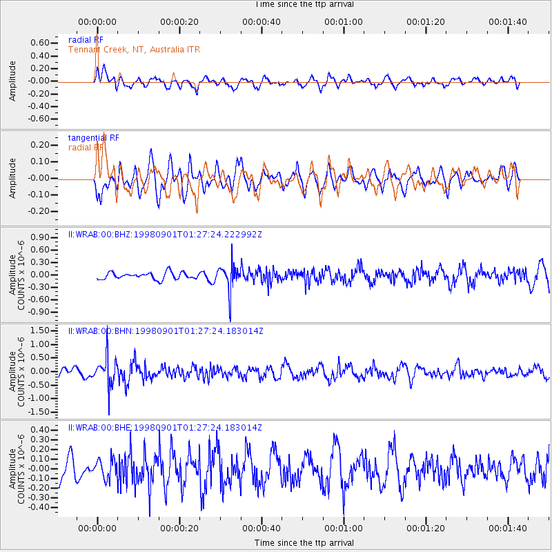
WRAB Tennant Creek, NT, Australia - Earthquake Result Viewer
*The percent match for this event was below the threshold and hence no stack was calculated.
| Earthquake location: |
Tonga Islands |
| Earthquake latitude/longitude: |
-17.6/-174.8 |
| Earthquake time(UTC): |
1998/09/01 (244) 01:19:37 GMT |
| Earthquake Depth: |
220 km |
| Earthquake Magnitude: |
5.6 UNKNOWN, 5.3 MB, 5.6 MW |
| Earthquake Catalog/Contributor: |
WHDF/NEIC |
|
| Network: |
II Global Seismograph Network (GSN - IRIS/IDA) |
| Station: |
WRAB Tennant Creek, NT, Australia |
| Lat/Lon: |
19.93 S/134.36 E |
| Elevation: |
366 m |
|
| Distance: |
48.1 deg |
| Az: |
258.738 deg |
| Baz: |
96.016 deg |
| Ray Param: |
$rayparam |
*The percent match for this event was below the threshold and hence was not used in the summary stack. |
|
| Radial Match: |
62.00022 % |
| Radial Bump: |
400 |
| Transverse Match: |
60.09314 % |
| Transverse Bump: |
400 |
| SOD ConfigId: |
4480 |
| Insert Time: |
2010-03-01 23:30:22.700 +0000 |
| GWidth: |
2.5 |
| Max Bumps: |
400 |
| Tol: |
0.001 |
|
Signal To Noise
| Channel | StoN | STA | LTA |
| II:WRAB:00:BHN:19980901T01:27:24.183014Z | 4.855484 | 5.4619767E-7 | 1.1249088E-7 |
| II:WRAB:00:BHE:19980901T01:27:24.183014Z | 0.7875957 | 9.947249E-8 | 1.2629891E-7 |
| II:WRAB:00:BHZ:19980901T01:27:24.222992Z | 3.8270445 | 3.1301744E-7 | 8.1790915E-8 |
| Arrivals |
| Ps | |
| PpPs | |
| PsPs/PpSs | |


