You are here: Home > Network List > II - Global Seismograph Network (GSN - IRIS/IDA) Stations List
> Station WRAB Tennant Creek, NT, Australia > Earthquake Result Viewer
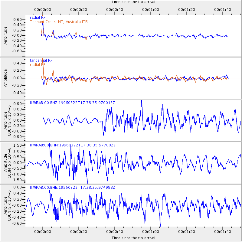
WRAB Tennant Creek, NT, Australia - Earthquake Result Viewer
*The percent match for this event was below the threshold and hence no stack was calculated.
| Earthquake location: |
East Of North Island, N.Z. |
| Earthquake latitude/longitude: |
-35.2/-179.2 |
| Earthquake time(UTC): |
1996/03/22 (082) 17:31:06 GMT |
| Earthquake Depth: |
33 km |
| Earthquake Magnitude: |
5.6 MB, 5.7 MS, 6.0 UNKNOWN, 5.7 MS |
| Earthquake Catalog/Contributor: |
WHDF/NEIC |
|
| Network: |
II Global Seismograph Network (GSN - IRIS/IDA) |
| Station: |
WRAB Tennant Creek, NT, Australia |
| Lat/Lon: |
19.93 S/134.36 E |
| Elevation: |
366 m |
|
| Distance: |
43.5 deg |
| Az: |
277.941 deg |
| Baz: |
120.492 deg |
| Ray Param: |
$rayparam |
*The percent match for this event was below the threshold and hence was not used in the summary stack. |
|
| Radial Match: |
74.33375 % |
| Radial Bump: |
400 |
| Transverse Match: |
57.29575 % |
| Transverse Bump: |
400 |
| SOD ConfigId: |
4480 |
| Insert Time: |
2010-03-01 23:30:36.169 +0000 |
| GWidth: |
2.5 |
| Max Bumps: |
400 |
| Tol: |
0.001 |
|
Signal To Noise
| Channel | StoN | STA | LTA |
| II:WRAB:00:BHN:19960322T17:38:35.977002Z | 3.9697106 | 6.003974E-7 | 1.5124463E-7 |
| II:WRAB:00:BHE:19960322T17:38:35.974988Z | 1.6341094 | 2.2073966E-7 | 1.3508256E-7 |
| II:WRAB:00:BHZ:19960322T17:38:35.970013Z | 2.2596464 | 2.8082877E-7 | 1.2427995E-7 |
| Arrivals |
| Ps | |
| PpPs | |
| PsPs/PpSs | |


