You are here: Home > Network List > II - Global Seismograph Network (GSN - IRIS/IDA) Stations List
> Station WRAB Tennant Creek, NT, Australia > Earthquake Result Viewer
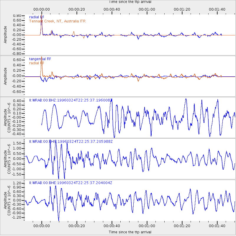
WRAB Tennant Creek, NT, Australia - Earthquake Result Viewer
*The percent match for this event was below the threshold and hence no stack was calculated.
| Earthquake location: |
West Of Macquarie Island |
| Earthquake latitude/longitude: |
-55.4/146.0 |
| Earthquake time(UTC): |
1996/03/24 (084) 22:19:02 GMT |
| Earthquake Depth: |
10 km |
| Earthquake Magnitude: |
5.3 MB, 5.8 MS, 6.1 UNKNOWN, 6.1 MW |
| Earthquake Catalog/Contributor: |
WHDF/NEIC |
|
| Network: |
II Global Seismograph Network (GSN - IRIS/IDA) |
| Station: |
WRAB Tennant Creek, NT, Australia |
| Lat/Lon: |
19.93 S/134.36 E |
| Elevation: |
366 m |
|
| Distance: |
36.5 deg |
| Az: |
341.383 deg |
| Baz: |
168.845 deg |
| Ray Param: |
$rayparam |
*The percent match for this event was below the threshold and hence was not used in the summary stack. |
|
| Radial Match: |
77.08294 % |
| Radial Bump: |
272 |
| Transverse Match: |
53.12612 % |
| Transverse Bump: |
400 |
| SOD ConfigId: |
4480 |
| Insert Time: |
2010-03-01 23:30:36.919 +0000 |
| GWidth: |
2.5 |
| Max Bumps: |
400 |
| Tol: |
0.001 |
|
Signal To Noise
| Channel | StoN | STA | LTA |
| II:WRAB:00:BHN:19960324T22:25:37.205988Z | 2.8282232 | 5.5175525E-7 | 1.9508902E-7 |
| II:WRAB:00:BHE:19960324T22:25:37.204004Z | 1.7918727 | 2.7415066E-7 | 1.5299673E-7 |
| II:WRAB:00:BHZ:19960324T22:25:37.196008Z | 1.0727938 | 1.7475543E-7 | 1.6289749E-7 |
| Arrivals |
| Ps | |
| PpPs | |
| PsPs/PpSs | |


