You are here: Home > Network List > II - Global Seismograph Network (GSN - IRIS/IDA) Stations List
> Station WRAB Tennant Creek, NT, Australia > Earthquake Result Viewer
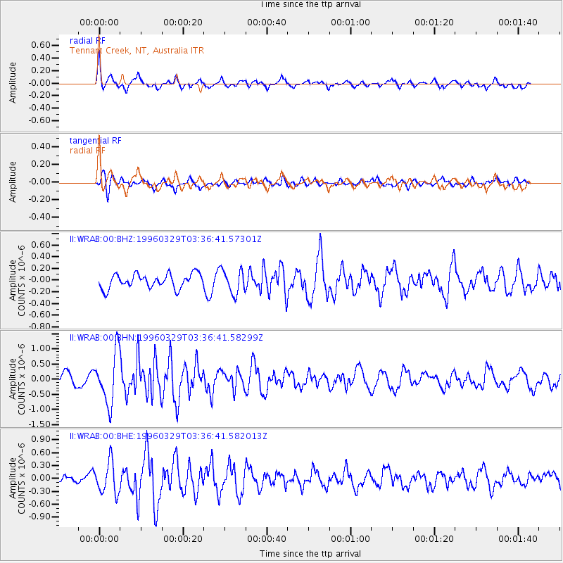
WRAB Tennant Creek, NT, Australia - Earthquake Result Viewer
*The percent match for this event was below the threshold and hence no stack was calculated.
| Earthquake location: |
Taiwan Region |
| Earthquake latitude/longitude: |
24.1/122.2 |
| Earthquake time(UTC): |
1996/03/29 (089) 03:28:56 GMT |
| Earthquake Depth: |
33 km |
| Earthquake Magnitude: |
5.5 MS, 5.4 MB, 5.8 UNKNOWN, 5.7 MW |
| Earthquake Catalog/Contributor: |
WHDF/NEIC |
|
| Network: |
II Global Seismograph Network (GSN - IRIS/IDA) |
| Station: |
WRAB Tennant Creek, NT, Australia |
| Lat/Lon: |
19.93 S/134.36 E |
| Elevation: |
366 m |
|
| Distance: |
45.4 deg |
| Az: |
163.828 deg |
| Baz: |
344.309 deg |
| Ray Param: |
$rayparam |
*The percent match for this event was below the threshold and hence was not used in the summary stack. |
|
| Radial Match: |
73.326324 % |
| Radial Bump: |
400 |
| Transverse Match: |
54.860622 % |
| Transverse Bump: |
400 |
| SOD ConfigId: |
4480 |
| Insert Time: |
2010-03-01 23:30:42.361 +0000 |
| GWidth: |
2.5 |
| Max Bumps: |
400 |
| Tol: |
0.001 |
|
Signal To Noise
| Channel | StoN | STA | LTA |
| II:WRAB:00:BHN:19960329T03:36:41.58299Z | 3.3907309 | 8.660172E-7 | 2.5540726E-7 |
| II:WRAB:00:BHE:19960329T03:36:41.582013Z | 3.5378265 | 3.7717143E-7 | 1.06611054E-7 |
| II:WRAB:00:BHZ:19960329T03:36:41.57301Z | 1.6787679 | 2.0287092E-7 | 1.2084513E-7 |
| Arrivals |
| Ps | |
| PpPs | |
| PsPs/PpSs | |


