CLF Chambon la Foret observatory, France - Earthquake Result Viewer
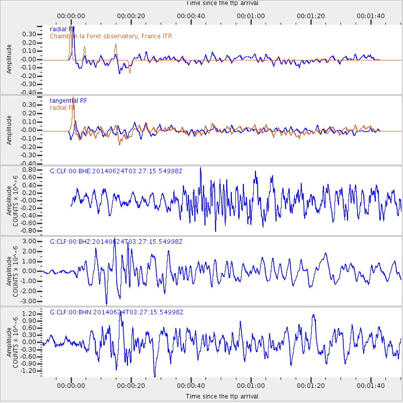
Earthquake location: Rat Islands, Aleutian Islands
Earthquake latitude/longitude: 52.3/176.7
Earthquake time(UTC): 2014/06/24 (175) 03:15:36 GMT
Earthquake Depth: 4.0 km
Earthquake Magnitude: 6.3 MWB, 5.7 ML, 6.4 MWC, 6.6 MI
Earthquake Catalog/Contributor: NEIC PDE/NEIC COMCAT
Network: G GEOSCOPE
Station: CLF Chambon la Foret observatory, France
Lat/Lon: 48.03 N/2.26 E
Elevation: 145 m
Distance: 80.0 deg
Az: 356.224 deg
Baz: 3.458 deg
Ray Param: 0.048595425
Estimated Moho Depth: 10.5 km
Estimated Crust Vp/Vs: 1.60
Assumed Crust Vp: 6.12 km/s
Estimated Crust Vs: 3.825 km/s
Estimated Crust Poisson's Ratio: 0.18
Radial Match: 86.68576 %
Radial Bump: 400
Transverse Match: 76.889626 %
Transverse Bump: 400
SOD ConfigId: 739768
Insert Time: 2014-07-08 03:41:52.993 +0000
GWidth: 2.5
Max Bumps: 400
Tol: 0.001

Signal To Noise

ChannelStoNSTALTA
G:CLF:00:BHZ:20140624T03:27:15.54998Z3.3290094.030631E-71.21076E-7
G:CLF:00:BHN:20140624T03:27:15.54998Z0.961456661.0439677E-71.0858188E-7
G:CLF:00:BHE:20140624T03:27:15.54998Z1.09655231.6450781E-71.5002279E-7
Arrivals
Ps1.1 SECOND
PpPs4.3 SECOND
PsPs/PpSs5.4 SECOND