You are here: Home > Network List > TA - USArray Transportable Network (new EarthScope stations) Stations List
> Station I23K Minto, Yukon-Koyukuk, AK, USA > Earthquake Result Viewer
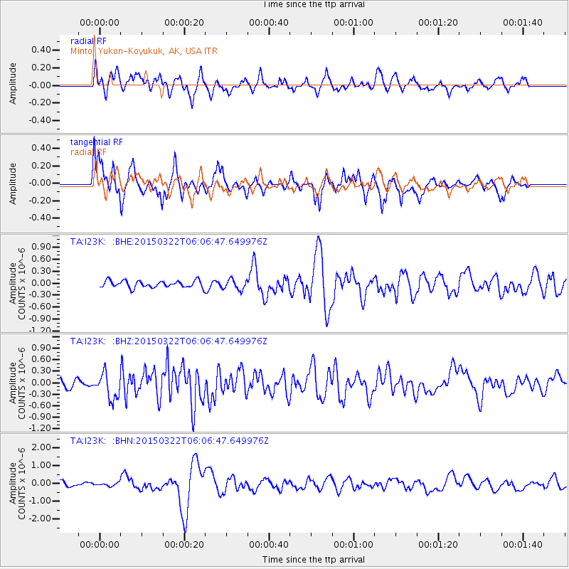
I23K Minto, Yukon-Koyukuk, AK, USA - Earthquake Result Viewer
*The percent match for this event was below the threshold and hence no stack was calculated.
| Earthquake location: |
Mariana Islands |
| Earthquake latitude/longitude: |
13.2/145.7 |
| Earthquake time(UTC): |
2015/03/22 (081) 05:56:22 GMT |
| Earthquake Depth: |
10 km |
| Earthquake Magnitude: |
5.5 MB |
| Earthquake Catalog/Contributor: |
NEIC PDE/NEIC ALERT |
|
| Network: |
TA USArray Transportable Network (new EarthScope stations) |
| Station: |
I23K Minto, Yukon-Koyukuk, AK, USA |
| Lat/Lon: |
65.15 N/149.36 W |
| Elevation: |
149 m |
|
| Distance: |
67.7 deg |
| Az: |
24.454 deg |
| Baz: |
252.553 deg |
| Ray Param: |
$rayparam |
*The percent match for this event was below the threshold and hence was not used in the summary stack. |
|
| Radial Match: |
50.9998 % |
| Radial Bump: |
399 |
| Transverse Match: |
35.19475 % |
| Transverse Bump: |
302 |
| SOD ConfigId: |
7422571 |
| Insert Time: |
2019-04-17 21:09:54.069 +0000 |
| GWidth: |
2.5 |
| Max Bumps: |
400 |
| Tol: |
0.001 |
|
Signal To Noise
| Channel | StoN | STA | LTA |
| TA:I23K: :BHZ:20150322T06:06:47.649976Z | 2.6458883 | 3.456758E-7 | 1.306464E-7 |
| TA:I23K: :BHN:20150322T06:06:47.649976Z | 0.71747845 | 1.0176666E-7 | 1.4183934E-7 |
| TA:I23K: :BHE:20150322T06:06:47.649976Z | 1.976949 | 1.882988E-7 | 9.524717E-8 |
| Arrivals |
| Ps | |
| PpPs | |
| PsPs/PpSs | |


