You are here: Home > Network List > II - Global Seismograph Network (GSN - IRIS/IDA) Stations List
> Station WRAB Tennant Creek, NT, Australia > Earthquake Result Viewer
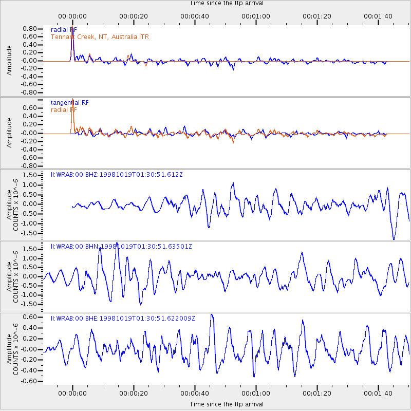
WRAB Tennant Creek, NT, Australia - Earthquake Result Viewer
*The percent match for this event was below the threshold and hence no stack was calculated.
| Earthquake location: |
Vanuatu Islands |
| Earthquake latitude/longitude: |
-17.3/167.8 |
| Earthquake time(UTC): |
1998/10/19 (292) 01:25:01 GMT |
| Earthquake Depth: |
33 km |
| Earthquake Magnitude: |
5.6 MS, 5.3 MB, 6.0 UNKNOWN, 5.9 MW |
| Earthquake Catalog/Contributor: |
WHDF/NEIC |
|
| Network: |
II Global Seismograph Network (GSN - IRIS/IDA) |
| Station: |
WRAB Tennant Creek, NT, Australia |
| Lat/Lon: |
19.93 S/134.36 E |
| Elevation: |
366 m |
|
| Distance: |
31.7 deg |
| Az: |
259.927 deg |
| Baz: |
90.801 deg |
| Ray Param: |
$rayparam |
*The percent match for this event was below the threshold and hence was not used in the summary stack. |
|
| Radial Match: |
73.357445 % |
| Radial Bump: |
369 |
| Transverse Match: |
70.31278 % |
| Transverse Bump: |
400 |
| SOD ConfigId: |
4480 |
| Insert Time: |
2010-03-01 23:30:53.679 +0000 |
| GWidth: |
2.5 |
| Max Bumps: |
400 |
| Tol: |
0.001 |
|
Signal To Noise
| Channel | StoN | STA | LTA |
| II:WRAB:00:BHN:19981019T01:30:51.63501Z | 2.3362768 | 4.1419327E-7 | 1.7728776E-7 |
| II:WRAB:00:BHE:19981019T01:30:51.622009Z | 1.2991325 | 1.9253096E-7 | 1.4819965E-7 |
| II:WRAB:00:BHZ:19981019T01:30:51.612Z | 1.61716 | 2.2138667E-7 | 1.3689844E-7 |
| Arrivals |
| Ps | |
| PpPs | |
| PsPs/PpSs | |


