You are here: Home > Network List > II - Global Seismograph Network (GSN - IRIS/IDA) Stations List
> Station WRAB Tennant Creek, NT, Australia > Earthquake Result Viewer
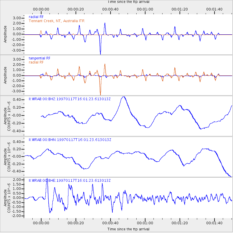
WRAB Tennant Creek, NT, Australia - Earthquake Result Viewer
*The percent match for this event was below the threshold and hence no stack was calculated.
| Earthquake location: |
Ryukyu Islands, Japan |
| Earthquake latitude/longitude: |
28.8/130.0 |
| Earthquake time(UTC): |
1997/01/17 (017) 15:53:13 GMT |
| Earthquake Depth: |
33 km |
| Earthquake Magnitude: |
5.9 MB, 6.3 MS, 6.3 UNKNOWN, 6.2 MW |
| Earthquake Catalog/Contributor: |
WHDF/NEIC |
|
| Network: |
II Global Seismograph Network (GSN - IRIS/IDA) |
| Station: |
WRAB Tennant Creek, NT, Australia |
| Lat/Lon: |
19.93 S/134.36 E |
| Elevation: |
366 m |
|
| Distance: |
48.6 deg |
| Az: |
174.474 deg |
| Baz: |
354.846 deg |
| Ray Param: |
$rayparam |
*The percent match for this event was below the threshold and hence was not used in the summary stack. |
|
| Radial Match: |
36.7096 % |
| Radial Bump: |
400 |
| Transverse Match: |
25.243057 % |
| Transverse Bump: |
351 |
| SOD ConfigId: |
4480 |
| Insert Time: |
2010-03-01 23:30:58.616 +0000 |
| GWidth: |
2.5 |
| Max Bumps: |
400 |
| Tol: |
0.001 |
|
Signal To Noise
| Channel | StoN | STA | LTA |
| II:WRAB:00:BHN:19970117T16:01:23.613013Z | 2.1133444 | 2.2018082E-7 | 1.0418596E-7 |
| II:WRAB:00:BHE:19970117T16:01:23.613013Z | 6.6765203 | 8.768027E-7 | 1.313263E-7 |
| II:WRAB:00:BHZ:19970117T16:01:23.613013Z | 0.7235274 | 6.547825E-8 | 9.0498645E-8 |
| Arrivals |
| Ps | |
| PpPs | |
| PsPs/PpSs | |


