KAPI Kappang, Sulawesi, Indonesia - Earthquake Result Viewer
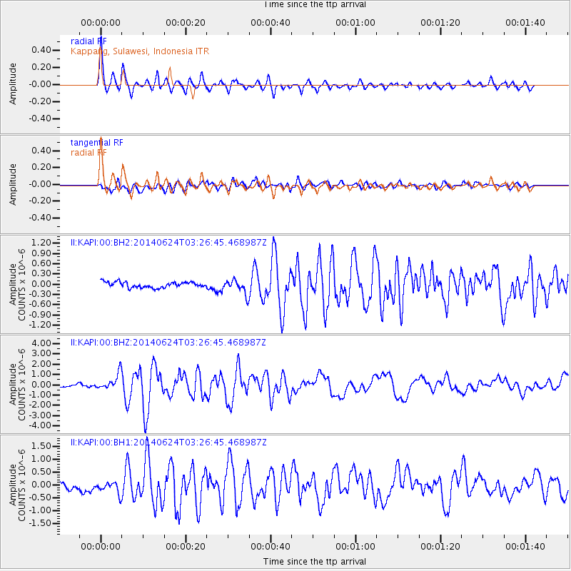
Earthquake location: Rat Islands, Aleutian Islands
Earthquake latitude/longitude: 52.3/176.7
Earthquake time(UTC): 2014/06/24 (175) 03:15:36 GMT
Earthquake Depth: 4.0 km
Earthquake Magnitude: 6.3 MWB, 5.7 ML, 6.4 MWC, 6.6 MI
Earthquake Catalog/Contributor: NEIC PDE/NEIC COMCAT
Network: II Global Seismograph Network (GSN - IRIS/IDA)
Station: KAPI Kappang, Sulawesi, Indonesia
Lat/Lon: 5.01 S/119.75 E
Elevation: 300 m
Distance: 74.6 deg
Az: 240.023 deg
Baz: 32.312 deg
Ray Param: 0.05222991
Estimated Moho Depth: 31.5 km
Estimated Crust Vp/Vs: 2.04
Assumed Crust Vp: 6.343 km/s
Estimated Crust Vs: 3.106 km/s
Estimated Crust Poisson's Ratio: 0.34
Radial Match: 92.775856 %
Radial Bump: 384
Transverse Match: 80.947525 %
Transverse Bump: 400
SOD ConfigId: 739768
Insert Time: 2014-07-08 03:46:29.992 +0000
GWidth: 2.5
Max Bumps: 400
Tol: 0.001

Signal To Noise

ChannelStoNSTALTA
II:KAPI:00:BHZ:20140624T03:26:45.468987Z6.01396858.084561E-71.3442971E-7
II:KAPI:00:BH1:20140624T03:26:45.468987Z1.97049342.4709354E-71.2539678E-7
II:KAPI:00:BH2:20140624T03:26:45.468987Z2.6113882.1390193E-78.19112E-8
Arrivals
Ps5.3 SECOND
PpPs15 SECOND
PsPs/PpSs20 SECOND