You are here: Home > Network List > II - Global Seismograph Network (GSN - IRIS/IDA) Stations List
> Station WRAB Tennant Creek, NT, Australia > Earthquake Result Viewer
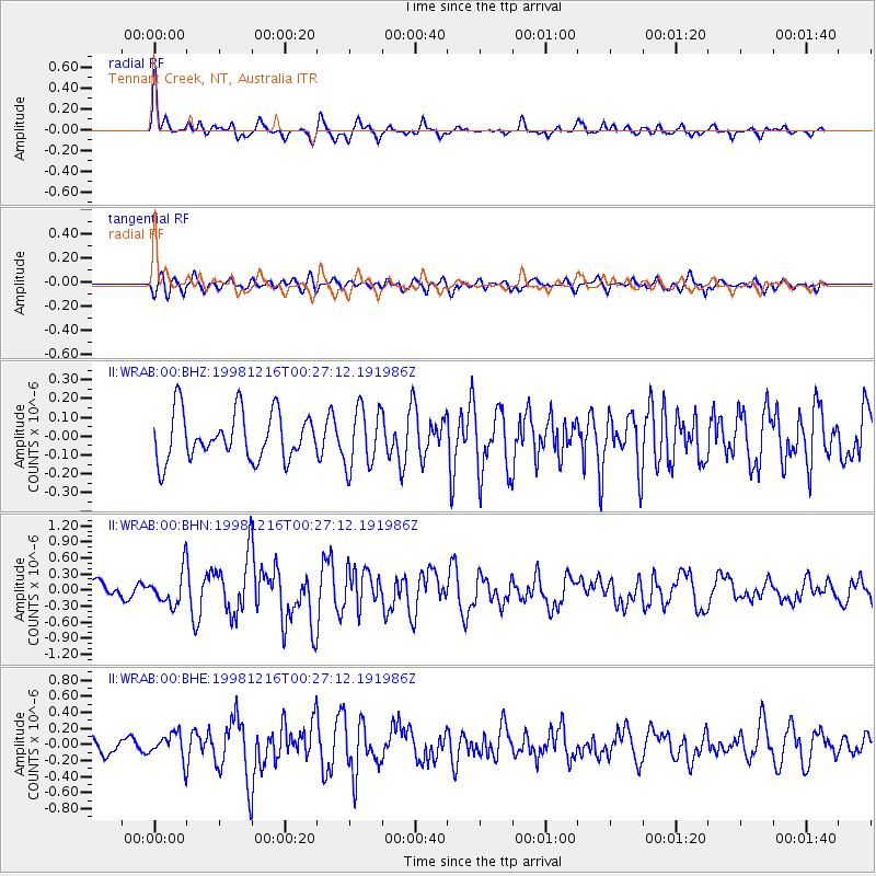
WRAB Tennant Creek, NT, Australia - Earthquake Result Viewer
*The percent match for this event was below the threshold and hence no stack was calculated.
| Earthquake location: |
Kyushu, Japan |
| Earthquake latitude/longitude: |
31.3/131.3 |
| Earthquake time(UTC): |
1998/12/16 (350) 00:18:45 GMT |
| Earthquake Depth: |
42 km |
| Earthquake Magnitude: |
5.5 MB, 5.6 MS, 6.0 UNKNOWN |
| Earthquake Catalog/Contributor: |
WHDF/NEIC |
|
| Network: |
II Global Seismograph Network (GSN - IRIS/IDA) |
| Station: |
WRAB Tennant Creek, NT, Australia |
| Lat/Lon: |
19.93 S/134.36 E |
| Elevation: |
366 m |
|
| Distance: |
51.0 deg |
| Az: |
176.278 deg |
| Baz: |
356.614 deg |
| Ray Param: |
$rayparam |
*The percent match for this event was below the threshold and hence was not used in the summary stack. |
|
| Radial Match: |
72.55578 % |
| Radial Bump: |
397 |
| Transverse Match: |
60.08837 % |
| Transverse Bump: |
400 |
| SOD ConfigId: |
4480 |
| Insert Time: |
2010-03-01 23:31:07.042 +0000 |
| GWidth: |
2.5 |
| Max Bumps: |
400 |
| Tol: |
0.001 |
|
Signal To Noise
| Channel | StoN | STA | LTA |
| II:WRAB:00:BHN:19981216T00:27:12.191986Z | 2.3598902 | 3.1631188E-7 | 1.340367E-7 |
| II:WRAB:00:BHE:19981216T00:27:12.191986Z | 1.5960647 | 1.6142872E-7 | 1.01141715E-7 |
| II:WRAB:00:BHZ:19981216T00:27:12.191986Z | 1.2716633 | 1.5881322E-7 | 1.2488621E-7 |
| Arrivals |
| Ps | |
| PpPs | |
| PsPs/PpSs | |


