You are here: Home > Network List > II - Global Seismograph Network (GSN - IRIS/IDA) Stations List
> Station WRAB Tennant Creek, NT, Australia > Earthquake Result Viewer
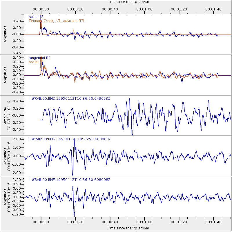
WRAB Tennant Creek, NT, Australia - Earthquake Result Viewer
*The percent match for this event was below the threshold and hence no stack was calculated.
| Earthquake location: |
Kuril Islands |
| Earthquake latitude/longitude: |
44.0/147.1 |
| Earthquake time(UTC): |
1995/01/12 (012) 10:26:46 GMT |
| Earthquake Depth: |
33 km |
| Earthquake Magnitude: |
6.2 MB, 5.4 MS, 6.1 UNKNOWN, 6.0 MW |
| Earthquake Catalog/Contributor: |
WHDF/NEIC |
|
| Network: |
II Global Seismograph Network (GSN - IRIS/IDA) |
| Station: |
WRAB Tennant Creek, NT, Australia |
| Lat/Lon: |
19.93 S/134.36 E |
| Elevation: |
366 m |
|
| Distance: |
64.7 deg |
| Az: |
193.258 deg |
| Baz: |
10.134 deg |
| Ray Param: |
$rayparam |
*The percent match for this event was below the threshold and hence was not used in the summary stack. |
|
| Radial Match: |
67.11922 % |
| Radial Bump: |
400 |
| Transverse Match: |
69.742874 % |
| Transverse Bump: |
400 |
| SOD ConfigId: |
4480 |
| Insert Time: |
2010-03-01 23:31:07.888 +0000 |
| GWidth: |
2.5 |
| Max Bumps: |
400 |
| Tol: |
0.001 |
|
Signal To Noise
| Channel | StoN | STA | LTA |
| II:WRAB:00:BHN:19950112T10:36:50.608008Z | 2.4379556 | 4.6202015E-7 | 1.8951131E-7 |
| II:WRAB:00:BHE:19950112T10:36:50.608008Z | 1.909691 | 2.7008636E-7 | 1.4142935E-7 |
| II:WRAB:00:BHZ:19950112T10:36:50.649023Z | 0.8637608 | 1.1648432E-7 | 1.3485715E-7 |
| Arrivals |
| Ps | |
| PpPs | |
| PsPs/PpSs | |


