You are here: Home > Network List > II - Global Seismograph Network (GSN - IRIS/IDA) Stations List
> Station WRAB Tennant Creek, NT, Australia > Earthquake Result Viewer
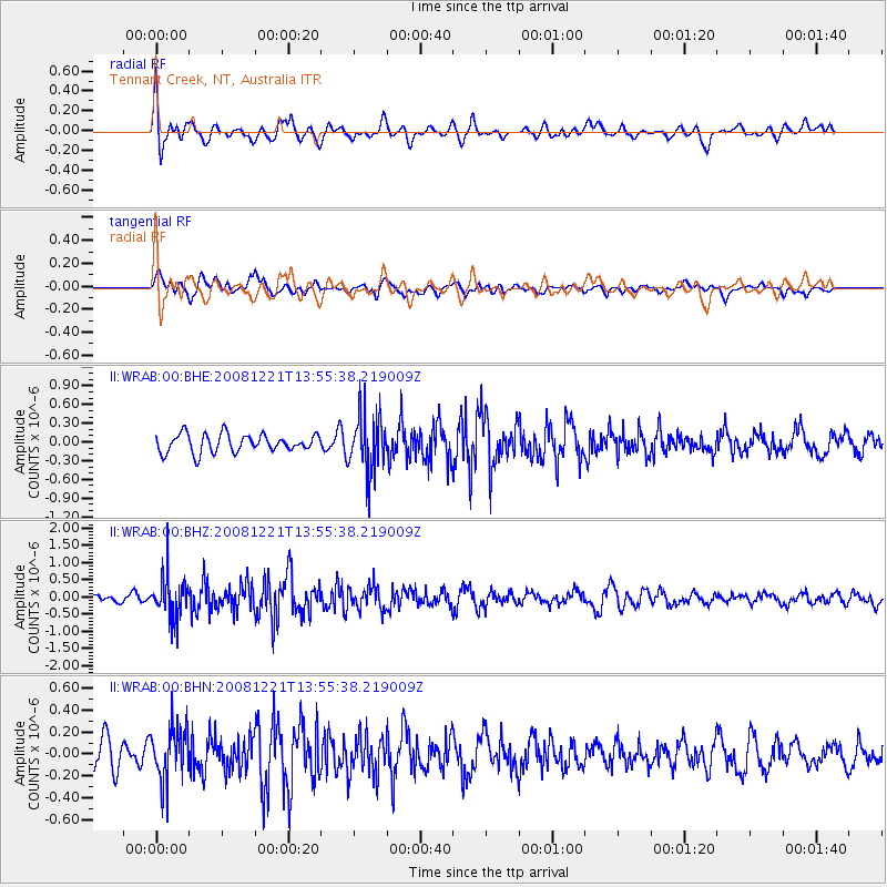
WRAB Tennant Creek, NT, Australia - Earthquake Result Viewer
*The percent match for this event was below the threshold and hence no stack was calculated.
| Earthquake location: |
Northern Sumatra, Indonesia |
| Earthquake latitude/longitude: |
4.8/95.0 |
| Earthquake time(UTC): |
2008/12/21 (356) 13:47:52 GMT |
| Earthquake Depth: |
56 km |
| Earthquake Magnitude: |
5.6 MB, 5.1 MS, 5.4 MW, 5.3 MW |
| Earthquake Catalog/Contributor: |
WHDF/NEIC |
|
| Network: |
II Global Seismograph Network (GSN - IRIS/IDA) |
| Station: |
WRAB Tennant Creek, NT, Australia |
| Lat/Lon: |
19.93 S/134.36 E |
| Elevation: |
366 m |
|
| Distance: |
45.8 deg |
| Az: |
123.77 deg |
| Baz: |
298.301 deg |
| Ray Param: |
$rayparam |
*The percent match for this event was below the threshold and hence was not used in the summary stack. |
|
| Radial Match: |
67.99524 % |
| Radial Bump: |
400 |
| Transverse Match: |
56.114132 % |
| Transverse Bump: |
400 |
| SOD ConfigId: |
2658 |
| Insert Time: |
2010-03-01 23:31:09.035 +0000 |
| GWidth: |
2.5 |
| Max Bumps: |
400 |
| Tol: |
0.001 |
|
Signal To Noise
| Channel | StoN | STA | LTA |
| II:WRAB:00:BHZ:20081221T13:55:38.219009Z | 4.46899 | 6.2100025E-7 | 1.3895763E-7 |
| II:WRAB:00:BHN:20081221T13:55:38.219009Z | 1.8983858 | 2.4477774E-7 | 1.2893993E-7 |
| II:WRAB:00:BHE:20081221T13:55:38.219009Z | 3.1736753 | 4.590076E-7 | 1.4462967E-7 |
| Arrivals |
| Ps | |
| PpPs | |
| PsPs/PpSs | |


