You are here: Home > Network List > II - Global Seismograph Network (GSN - IRIS/IDA) Stations List
> Station WRAB Tennant Creek, NT, Australia > Earthquake Result Viewer
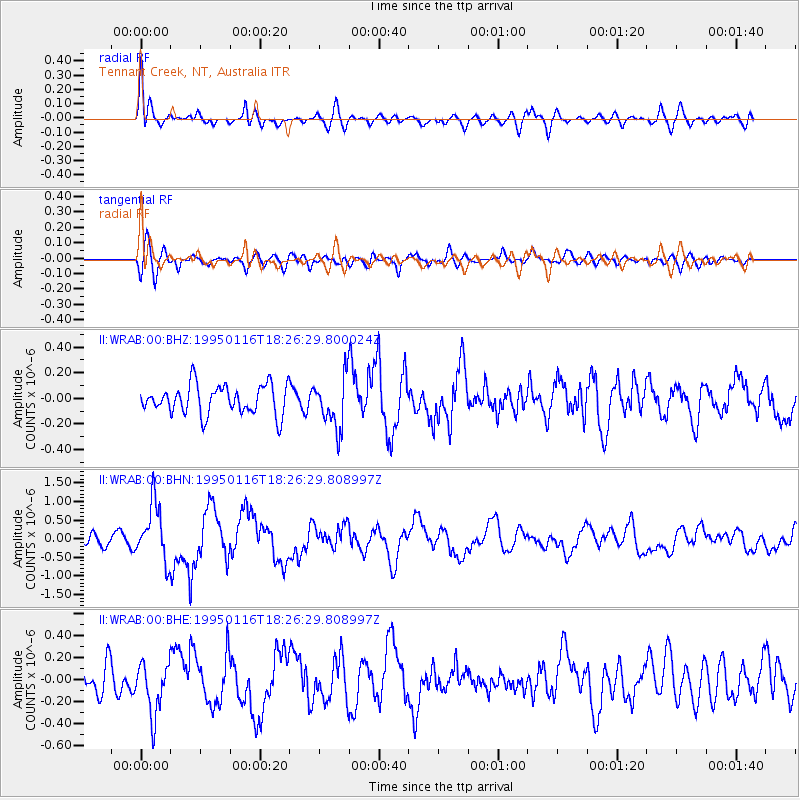
WRAB Tennant Creek, NT, Australia - Earthquake Result Viewer
*The percent match for this event was below the threshold and hence no stack was calculated.
| Earthquake location: |
Rat Islands, Aleutian Islands |
| Earthquake latitude/longitude: |
51.2/179.2 |
| Earthquake time(UTC): |
1995/01/16 (016) 18:14:49 GMT |
| Earthquake Depth: |
33 km |
| Earthquake Magnitude: |
5.5 MB, 6.0 MS, 6.3 UNKNOWN, 6.1 MW |
| Earthquake Catalog/Contributor: |
WHDF/NEIC |
|
| Network: |
II Global Seismograph Network (GSN - IRIS/IDA) |
| Station: |
WRAB Tennant Creek, NT, Australia |
| Lat/Lon: |
19.93 S/134.36 E |
| Elevation: |
366 m |
|
| Distance: |
81.0 deg |
| Az: |
222.167 deg |
| Baz: |
26.649 deg |
| Ray Param: |
$rayparam |
*The percent match for this event was below the threshold and hence was not used in the summary stack. |
|
| Radial Match: |
74.32182 % |
| Radial Bump: |
400 |
| Transverse Match: |
63.042076 % |
| Transverse Bump: |
400 |
| SOD ConfigId: |
4480 |
| Insert Time: |
2010-03-01 23:31:10.089 +0000 |
| GWidth: |
2.5 |
| Max Bumps: |
400 |
| Tol: |
0.001 |
|
Signal To Noise
| Channel | StoN | STA | LTA |
| II:WRAB:00:BHN:19950116T18:26:29.808997Z | 5.578268 | 7.6377216E-7 | 1.3691923E-7 |
| II:WRAB:00:BHE:19950116T18:26:29.808997Z | 1.2761873 | 2.399797E-7 | 1.8804425E-7 |
| II:WRAB:00:BHZ:19950116T18:26:29.800024Z | 1.7120379 | 1.9501162E-7 | 1.1390613E-7 |
| Arrivals |
| Ps | |
| PpPs | |
| PsPs/PpSs | |


