You are here: Home > Network List > II - Global Seismograph Network (GSN - IRIS/IDA) Stations List
> Station WRAB Tennant Creek, NT, Australia > Earthquake Result Viewer
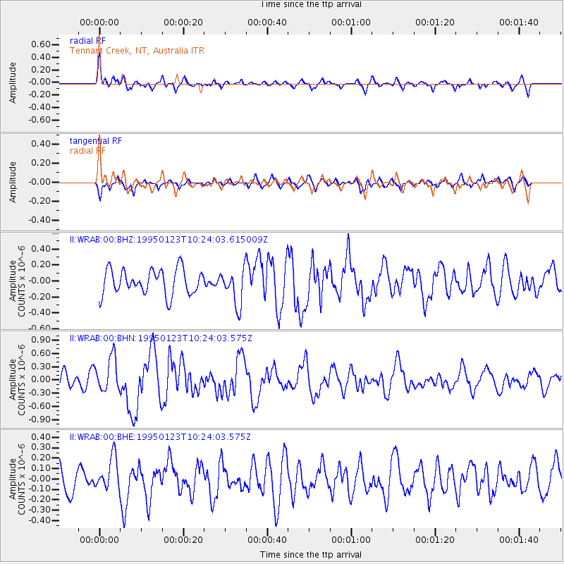
WRAB Tennant Creek, NT, Australia - Earthquake Result Viewer
*The percent match for this event was below the threshold and hence no stack was calculated.
| Earthquake location: |
South Of Fiji Islands |
| Earthquake latitude/longitude: |
-26.8/-176.4 |
| Earthquake time(UTC): |
1995/01/23 (023) 10:16:18 GMT |
| Earthquake Depth: |
33 km |
| Earthquake Magnitude: |
5.3 MB, 5.7 MS, 6.0 UNKNOWN, 5.8 MW |
| Earthquake Catalog/Contributor: |
WHDF/NEIC |
|
| Network: |
II Global Seismograph Network (GSN - IRIS/IDA) |
| Station: |
WRAB Tennant Creek, NT, Australia |
| Lat/Lon: |
19.93 S/134.36 E |
| Elevation: |
366 m |
|
| Distance: |
45.5 deg |
| Az: |
267.844 deg |
| Baz: |
108.371 deg |
| Ray Param: |
$rayparam |
*The percent match for this event was below the threshold and hence was not used in the summary stack. |
|
| Radial Match: |
70.95753 % |
| Radial Bump: |
360 |
| Transverse Match: |
54.377956 % |
| Transverse Bump: |
400 |
| SOD ConfigId: |
4480 |
| Insert Time: |
2010-03-01 23:31:17.928 +0000 |
| GWidth: |
2.5 |
| Max Bumps: |
400 |
| Tol: |
0.001 |
|
Signal To Noise
| Channel | StoN | STA | LTA |
| II:WRAB:00:BHN:19950123T10:24:03.575Z | 2.231813 | 3.940494E-7 | 1.7656022E-7 |
| II:WRAB:00:BHE:19950123T10:24:03.575Z | 1.0197768 | 1.6583071E-7 | 1.6261473E-7 |
| II:WRAB:00:BHZ:19950123T10:24:03.615009Z | 1.4920924 | 2.3360894E-7 | 1.5656467E-7 |
| Arrivals |
| Ps | |
| PpPs | |
| PsPs/PpSs | |


