You are here: Home > Network List > II - Global Seismograph Network (GSN - IRIS/IDA) Stations List
> Station WRAB Tennant Creek, NT, Australia > Earthquake Result Viewer
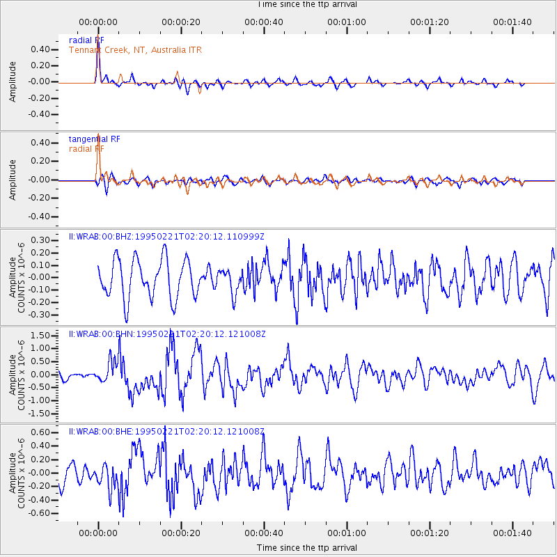
WRAB Tennant Creek, NT, Australia - Earthquake Result Viewer
*The percent match for this event was below the threshold and hence no stack was calculated.
| Earthquake location: |
Kuril Islands |
| Earthquake latitude/longitude: |
45.9/151.6 |
| Earthquake time(UTC): |
1995/02/21 (052) 02:09:50 GMT |
| Earthquake Depth: |
33 km |
| Earthquake Magnitude: |
5.8 MB, 5.9 MS, 6.2 UNKNOWN, 6.1 MW |
| Earthquake Catalog/Contributor: |
WHDF/NEIC |
|
| Network: |
II Global Seismograph Network (GSN - IRIS/IDA) |
| Station: |
WRAB Tennant Creek, NT, Australia |
| Lat/Lon: |
19.93 S/134.36 E |
| Elevation: |
366 m |
|
| Distance: |
67.4 deg |
| Az: |
197.532 deg |
| Baz: |
12.911 deg |
| Ray Param: |
$rayparam |
*The percent match for this event was below the threshold and hence was not used in the summary stack. |
|
| Radial Match: |
77.23351 % |
| Radial Bump: |
386 |
| Transverse Match: |
60.445427 % |
| Transverse Bump: |
400 |
| SOD ConfigId: |
4480 |
| Insert Time: |
2010-03-01 23:31:30.817 +0000 |
| GWidth: |
2.5 |
| Max Bumps: |
400 |
| Tol: |
0.001 |
|
Signal To Noise
| Channel | StoN | STA | LTA |
| II:WRAB:00:BHN:19950221T02:20:12.121008Z | 3.455928 | 4.323517E-7 | 1.2510436E-7 |
| II:WRAB:00:BHE:19950221T02:20:12.121008Z | 1.323958 | 1.8120326E-7 | 1.3686481E-7 |
| II:WRAB:00:BHZ:19950221T02:20:12.110999Z | 0.65038097 | 1.0004782E-7 | 1.5382957E-7 |
| Arrivals |
| Ps | |
| PpPs | |
| PsPs/PpSs | |


