You are here: Home > Network List > II - Global Seismograph Network (GSN - IRIS/IDA) Stations List
> Station WRAB Tennant Creek, NT, Australia > Earthquake Result Viewer
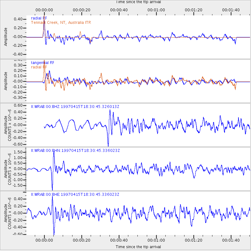
WRAB Tennant Creek, NT, Australia - Earthquake Result Viewer
*The percent match for this event was below the threshold and hence no stack was calculated.
| Earthquake location: |
Southern Xinjiang, China |
| Earthquake latitude/longitude: |
39.6/77.0 |
| Earthquake time(UTC): |
1997/04/15 (105) 18:19:10 GMT |
| Earthquake Depth: |
23 km |
| Earthquake Magnitude: |
5.8 MS, 5.4 MB, 5.9 UNKNOWN, 5.7 MW |
| Earthquake Catalog/Contributor: |
WHDF/NEIC |
|
| Network: |
II Global Seismograph Network (GSN - IRIS/IDA) |
| Station: |
WRAB Tennant Creek, NT, Australia |
| Lat/Lon: |
19.93 S/134.36 E |
| Elevation: |
366 m |
|
| Distance: |
79.8 deg |
| Az: |
126.395 deg |
| Baz: |
318.646 deg |
| Ray Param: |
$rayparam |
*The percent match for this event was below the threshold and hence was not used in the summary stack. |
|
| Radial Match: |
64.48304 % |
| Radial Bump: |
379 |
| Transverse Match: |
59.601242 % |
| Transverse Bump: |
400 |
| SOD ConfigId: |
4480 |
| Insert Time: |
2010-03-01 23:31:32.339 +0000 |
| GWidth: |
2.5 |
| Max Bumps: |
400 |
| Tol: |
0.001 |
|
Signal To Noise
| Channel | StoN | STA | LTA |
| II:WRAB:00:BHN:19970415T18:30:45.336023Z | 6.071914 | 5.594235E-7 | 9.2132964E-8 |
| II:WRAB:00:BHE:19970415T18:30:45.336023Z | 1.5444754 | 1.5653384E-7 | 1.0135082E-7 |
| II:WRAB:00:BHZ:19970415T18:30:45.326013Z | 1.9155142 | 2.0333295E-7 | 1.0615058E-7 |
| Arrivals |
| Ps | |
| PpPs | |
| PsPs/PpSs | |


