You are here: Home > Network List > II - Global Seismograph Network (GSN - IRIS/IDA) Stations List
> Station WRAB Tennant Creek, NT, Australia > Earthquake Result Viewer
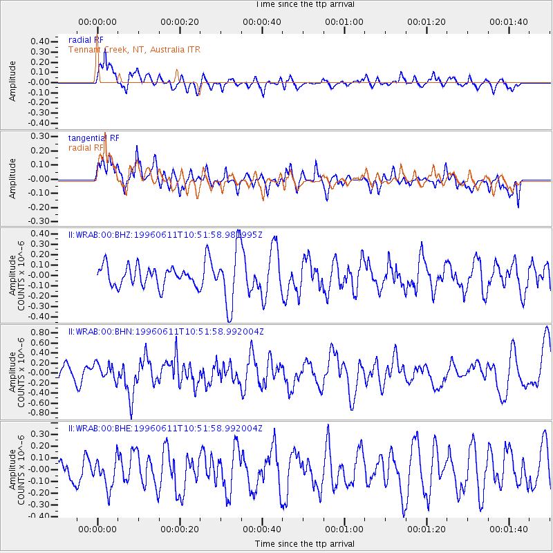
WRAB Tennant Creek, NT, Australia - Earthquake Result Viewer
*The percent match for this event was below the threshold and hence no stack was calculated.
| Earthquake location: |
Andreanof Islands, Aleutian Is. |
| Earthquake latitude/longitude: |
51.3/-176.3 |
| Earthquake time(UTC): |
1996/06/11 (163) 10:40:08 GMT |
| Earthquake Depth: |
33 km |
| Earthquake Magnitude: |
5.6 MB, 5.6 MS, 6.0 UNKNOWN, 5.5 MS |
| Earthquake Catalog/Contributor: |
WHDF/NEIC |
|
| Network: |
II Global Seismograph Network (GSN - IRIS/IDA) |
| Station: |
WRAB Tennant Creek, NT, Australia |
| Lat/Lon: |
19.93 S/134.36 E |
| Elevation: |
366 m |
|
| Distance: |
83.1 deg |
| Az: |
226.009 deg |
| Baz: |
28.707 deg |
| Ray Param: |
$rayparam |
*The percent match for this event was below the threshold and hence was not used in the summary stack. |
|
| Radial Match: |
58.985287 % |
| Radial Bump: |
400 |
| Transverse Match: |
52.36828 % |
| Transverse Bump: |
400 |
| SOD ConfigId: |
4480 |
| Insert Time: |
2010-03-01 23:31:33.987 +0000 |
| GWidth: |
2.5 |
| Max Bumps: |
400 |
| Tol: |
0.001 |
|
Signal To Noise
| Channel | StoN | STA | LTA |
| II:WRAB:00:BHN:19960611T10:51:58.992004Z | 1.484185 | 1.6712363E-7 | 1.1260297E-7 |
| II:WRAB:00:BHE:19960611T10:51:58.992004Z | 0.7893626 | 1.237843E-7 | 1.568155E-7 |
| II:WRAB:00:BHZ:19960611T10:51:58.981995Z | 3.2377052 | 2.9131797E-7 | 8.997668E-8 |
| Arrivals |
| Ps | |
| PpPs | |
| PsPs/PpSs | |


