435B Jarrell, TX, USA - Earthquake Result Viewer
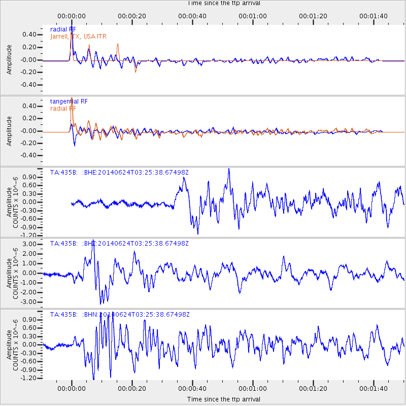
Earthquake location: Rat Islands, Aleutian Islands
Earthquake latitude/longitude: 52.3/176.7
Earthquake time(UTC): 2014/06/24 (175) 03:15:36 GMT
Earthquake Depth: 4.0 km
Earthquake Magnitude: 6.3 MWB, 5.7 ML, 6.4 MWC, 6.6 MI
Earthquake Catalog/Contributor: NEIC PDE/NEIC COMCAT
Network: TA USArray Transportable Network (new EarthScope stations)
Station: 435B Jarrell, TX, USA
Lat/Lon: 30.78 N/97.58 W
Elevation: 248 m
Distance: 63.8 deg
Az: 73.013 deg
Baz: 316.91 deg
Ray Param: 0.059346616
Estimated Moho Depth: 15.0 km
Estimated Crust Vp/Vs: 1.60
Assumed Crust Vp: 6.347 km/s
Estimated Crust Vs: 3.967 km/s
Estimated Crust Poisson's Ratio: 0.18
Radial Match: 92.01077 %
Radial Bump: 400
Transverse Match: 85.35715 %
Transverse Bump: 400
SOD ConfigId: 739768
Insert Time: 2014-07-08 04:08:45.195 +0000
GWidth: 2.5
Max Bumps: 400
Tol: 0.001

Signal To Noise

ChannelStoNSTALTA
TA:435B: :BHZ:20140624T03:25:38.67498Z9.5155796.4977314E-76.828519E-8
TA:435B: :BHN:20140624T03:25:38.67498Z2.2514742.4625635E-71.0937562E-7
TA:435B: :BHE:20140624T03:25:38.67498Z1.72739651.1166121E-76.464133E-8
Arrivals
Ps1.5 SECOND
PpPs5.9 SECOND
PsPs/PpSs7.3 SECOND