D50A G1974 Best Township, ON, CAN - Earthquake Result Viewer
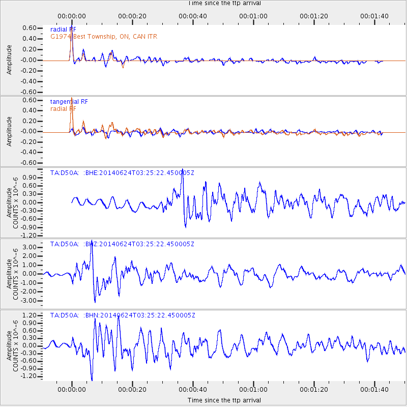
Earthquake location: Rat Islands, Aleutian Islands
Earthquake latitude/longitude: 52.3/176.7
Earthquake time(UTC): 2014/06/24 (175) 03:15:36 GMT
Earthquake Depth: 4.0 km
Earthquake Magnitude: 6.3 MWB, 5.7 ML, 6.4 MWC, 6.6 MI
Earthquake Catalog/Contributor: NEIC PDE/NEIC COMCAT
Network: TA USArray Transportable Network (new EarthScope stations)
Station: D50A G1974 Best Township, ON, CAN
Lat/Lon: 47.17 N/79.84 W
Elevation: 331 m
Distance: 61.4 deg
Az: 49.116 deg
Baz: 317.065 deg
Ray Param: 0.060926635
Estimated Moho Depth: 34.0 km
Estimated Crust Vp/Vs: 1.70
Assumed Crust Vp: 6.622 km/s
Estimated Crust Vs: 3.89 km/s
Estimated Crust Poisson's Ratio: 0.24
Radial Match: 83.8339 %
Radial Bump: 326
Transverse Match: 73.65911 %
Transverse Bump: 400
SOD ConfigId: 739768
Insert Time: 2014-07-08 04:09:19.202 +0000
GWidth: 2.5
Max Bumps: 400
Tol: 0.001

Signal To Noise

ChannelStoNSTALTA
TA:D50A: :BHZ:20140624T03:25:22.450005Z4.5123967.395483E-71.638926E-7
TA:D50A: :BHN:20140624T03:25:22.450005Z1.80276761.9995748E-71.1091695E-7
TA:D50A: :BHE:20140624T03:25:22.450005Z1.70230662.3560416E-71.384029E-7
Arrivals
Ps3.8 SECOND
PpPs13 SECOND
PsPs/PpSs17 SECOND