D57A Chemin Vers le Barrage, Saint-Michel-Des-Saints, Q - Earthquake Result Viewer
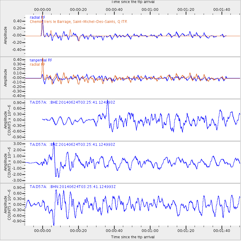
Earthquake location: Rat Islands, Aleutian Islands
Earthquake latitude/longitude: 52.3/176.7
Earthquake time(UTC): 2014/06/24 (175) 03:15:36 GMT
Earthquake Depth: 4.0 km
Earthquake Magnitude: 6.3 MWB, 5.7 ML, 6.4 MWC, 6.6 MI
Earthquake Catalog/Contributor: NEIC PDE/NEIC COMCAT
Network: TA USArray Transportable Network (new EarthScope stations)
Station: D57A Chemin Vers le Barrage, Saint-Michel-Des-Saints, Q
Lat/Lon: 47.02 N/73.89 W
Elevation: 422 m
Distance: 64.2 deg
Az: 45.803 deg
Baz: 319.898 deg
Ray Param: 0.059099875
Estimated Moho Depth: 18.0 km
Estimated Crust Vp/Vs: 1.96
Assumed Crust Vp: 6.61 km/s
Estimated Crust Vs: 3.372 km/s
Estimated Crust Poisson's Ratio: 0.32
Radial Match: 81.940865 %
Radial Bump: 390
Transverse Match: 67.44913 %
Transverse Bump: 400
SOD ConfigId: 739768
Insert Time: 2014-07-08 04:09:48.362 +0000
GWidth: 2.5
Max Bumps: 400
Tol: 0.001

Signal To Noise

ChannelStoNSTALTA
TA:D57A: :BHZ:20140624T03:25:41.124993Z2.82032426.314871E-72.2390587E-7
TA:D57A: :BHN:20140624T03:25:41.124993Z1.2905042.1375787E-71.6563907E-7
TA:D57A: :BHE:20140624T03:25:41.124993Z1.95658842.1564144E-71.1021298E-7
Arrivals
Ps2.7 SECOND
PpPs7.7 SECOND
PsPs/PpSs10 SECOND