
I55A Frankford, ON, CAN - Earthquake Result Viewer
| ||||||||||||||||||
| ||||||||||||||||||
| ||||||||||||||||||
|
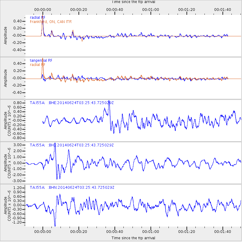
Signal To Noise
| Channel | StoN | STA | LTA |
| TA:I55A: :BHZ:20140624T03:25:43.725029Z | 4.208718 | 7.2096776E-7 | 1.7130341E-7 |
| TA:I55A: :BHN:20140624T03:25:43.725029Z | 3.3938503 | 2.9325696E-7 | 8.640834E-8 |
| TA:I55A: :BHE:20140624T03:25:43.725029Z | 2.5570936 | 2.4738426E-7 | 9.6744316E-8 |
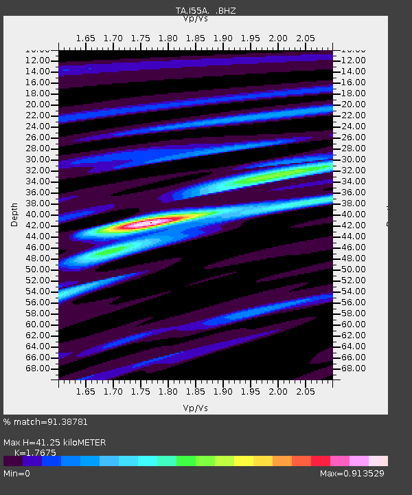
| Arrivals | |
| Ps | 5.0 SECOND |
| PpPs | 17 SECOND |
| PsPs/PpSs | 22 SECOND |

