
J49A Marlette, MI, USA - Earthquake Result Viewer
| ||||||||||||||||||
| ||||||||||||||||||
| ||||||||||||||||||
|
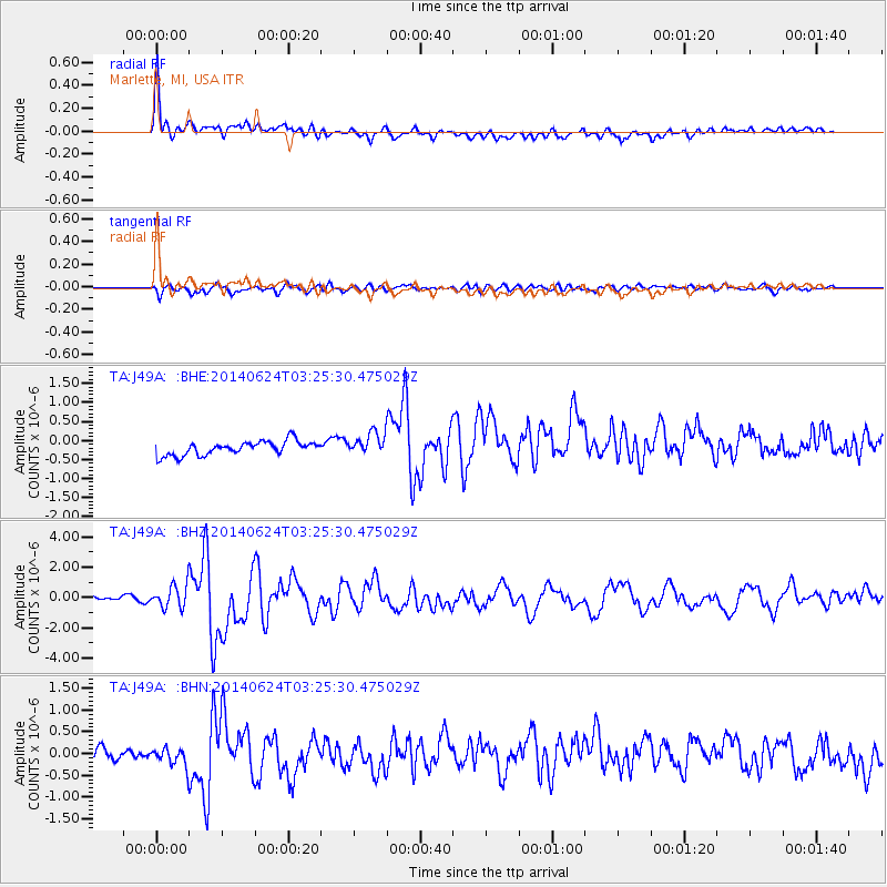
Signal To Noise
| Channel | StoN | STA | LTA |
| TA:J49A: :BHZ:20140624T03:25:30.475029Z | 3.2720714 | 7.689933E-7 | 2.3501728E-7 |
| TA:J49A: :BHN:20140624T03:25:30.475029Z | 1.7176228 | 2.3227513E-7 | 1.3523058E-7 |
| TA:J49A: :BHE:20140624T03:25:30.475029Z | 1.6074061 | 2.9475495E-7 | 1.8337305E-7 |
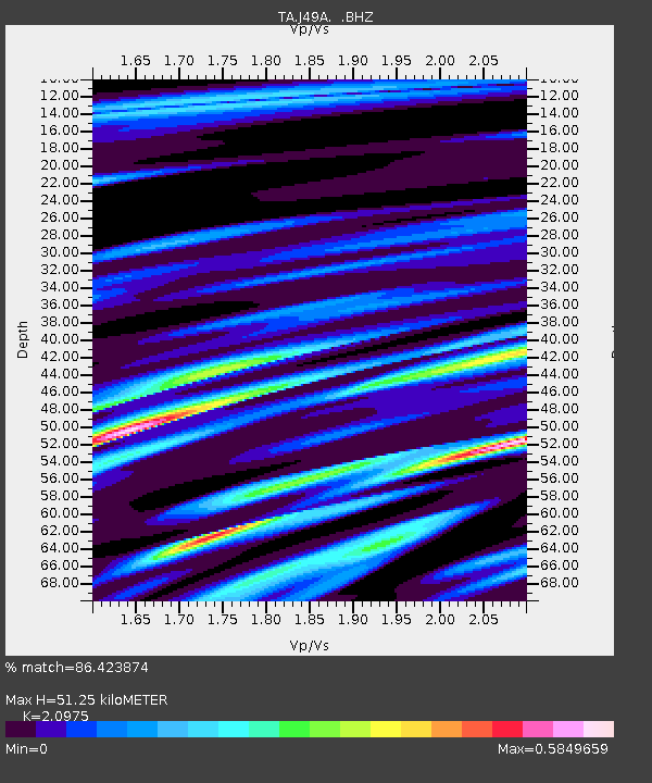
| Arrivals | |
| Ps | 9.0 SECOND |
| PpPs | 24 SECOND |
| PsPs/PpSs | 33 SECOND |

