J54A Appleton, NY, USA - Earthquake Result Viewer
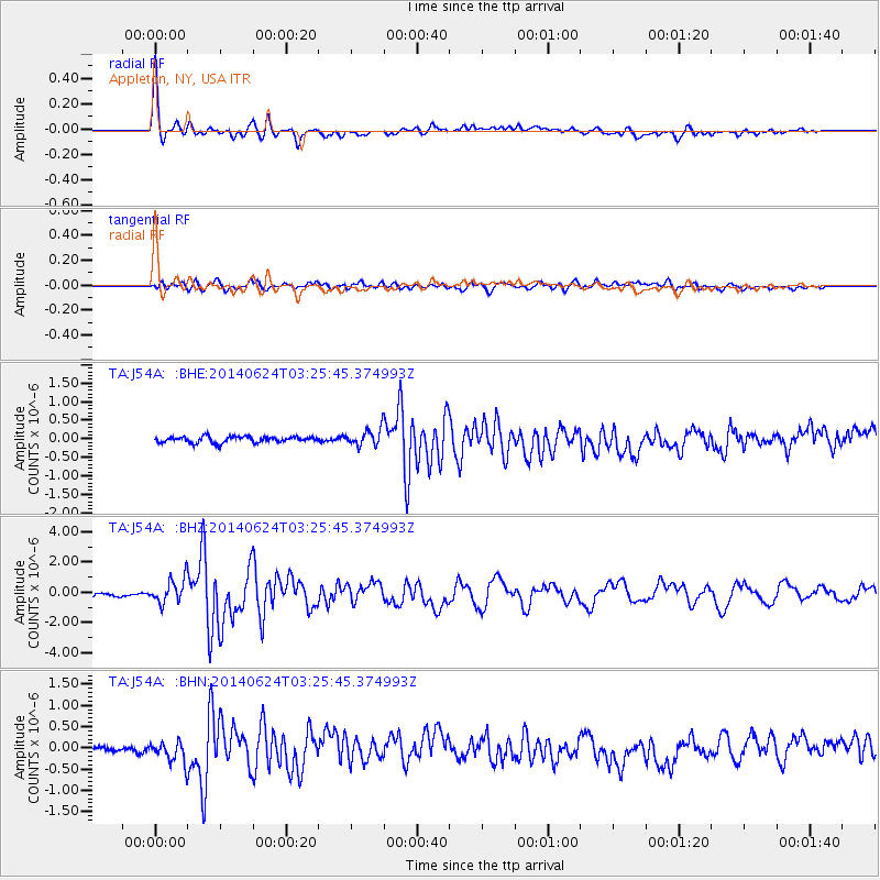
Earthquake location: Rat Islands, Aleutian Islands
Earthquake latitude/longitude: 52.3/176.7
Earthquake time(UTC): 2014/06/24 (175) 03:15:36 GMT
Earthquake Depth: 4.0 km
Earthquake Magnitude: 6.3 MWB, 5.7 ML, 6.4 MWC, 6.6 MI
Earthquake Catalog/Contributor: NEIC PDE/NEIC COMCAT
Network: TA USArray Transportable Network (new EarthScope stations)
Station: J54A Appleton, NY, USA
Lat/Lon: 43.27 N/78.64 W
Elevation: 112 m
Distance: 64.8 deg
Az: 51.33 deg
Baz: 318.918 deg
Ray Param: 0.058678996
Estimated Moho Depth: 41.5 km
Estimated Crust Vp/Vs: 1.80
Assumed Crust Vp: 6.419 km/s
Estimated Crust Vs: 3.571 km/s
Estimated Crust Poisson's Ratio: 0.28
Radial Match: 93.61367 %
Radial Bump: 398
Transverse Match: 76.97921 %
Transverse Bump: 400
SOD ConfigId: 739768
Insert Time: 2014-07-08 04:14:30.725 +0000
GWidth: 2.5
Max Bumps: 400
Tol: 0.001

Signal To Noise

ChannelStoNSTALTA
TA:J54A: :BHZ:20140624T03:25:45.374993Z7.1595168.175622E-71.1419238E-7
TA:J54A: :BHN:20140624T03:25:45.374993Z3.19814632.6680223E-78.342401E-8
TA:J54A: :BHE:20140624T03:25:45.374993Z2.7391532.2695207E-78.285484E-8
Arrivals
Ps5.4 SECOND
PpPs17 SECOND
PsPs/PpSs23 SECOND