You are here: Home > Network List > II - Global Seismograph Network (GSN - IRIS/IDA) Stations List
> Station WRAB Tennant Creek, NT, Australia > Earthquake Result Viewer
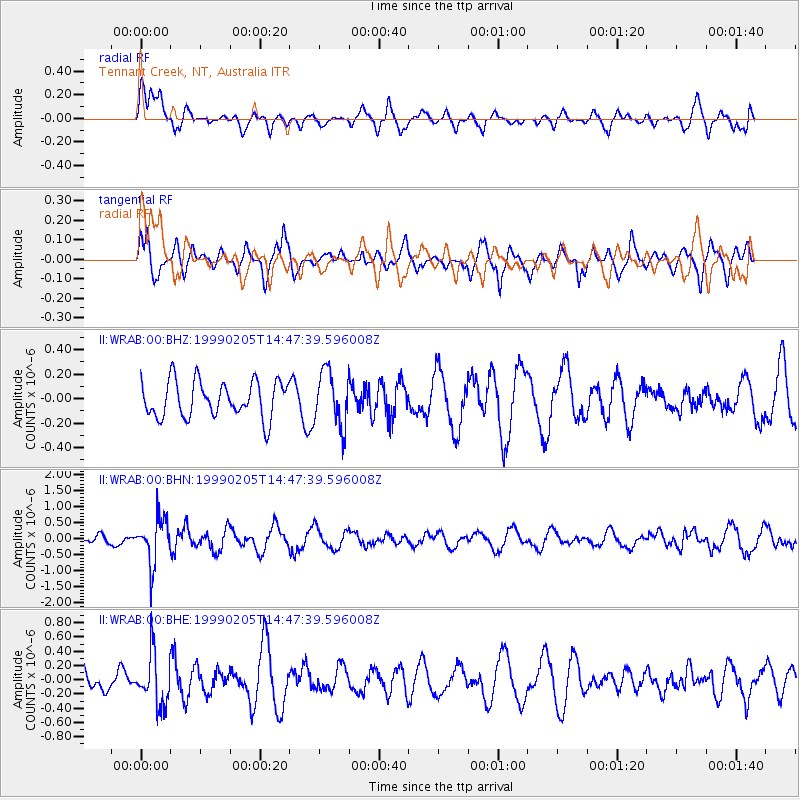
WRAB Tennant Creek, NT, Australia - Earthquake Result Viewer
*The percent match for this event was below the threshold and hence no stack was calculated.
| Earthquake location: |
Northwest Of Kuril Islands |
| Earthquake latitude/longitude: |
47.5/147.2 |
| Earthquake time(UTC): |
1999/02/05 (036) 14:37:53 GMT |
| Earthquake Depth: |
407 km |
| Earthquake Magnitude: |
6.0 MW, 5.4 MB, 5.8 MW |
| Earthquake Catalog/Contributor: |
WHDF/NEIC |
|
| Network: |
II Global Seismograph Network (GSN - IRIS/IDA) |
| Station: |
WRAB Tennant Creek, NT, Australia |
| Lat/Lon: |
19.93 S/134.36 E |
| Elevation: |
366 m |
|
| Distance: |
68.1 deg |
| Az: |
192.98 deg |
| Baz: |
9.315 deg |
| Ray Param: |
$rayparam |
*The percent match for this event was below the threshold and hence was not used in the summary stack. |
|
| Radial Match: |
66.10377 % |
| Radial Bump: |
400 |
| Transverse Match: |
59.430588 % |
| Transverse Bump: |
369 |
| SOD ConfigId: |
4480 |
| Insert Time: |
2010-03-01 23:31:49.112 +0000 |
| GWidth: |
2.5 |
| Max Bumps: |
400 |
| Tol: |
0.001 |
|
Signal To Noise
| Channel | StoN | STA | LTA |
| II:WRAB:00:BHN:19990205T14:47:39.596008Z | 3.1853032 | 7.206427E-7 | 2.262399E-7 |
| II:WRAB:00:BHE:19990205T14:47:39.596008Z | 2.560225 | 3.6431658E-7 | 1.4229866E-7 |
| II:WRAB:00:BHZ:19990205T14:47:39.596008Z | 1.5114377 | 2.2336579E-7 | 1.4778367E-7 |
| Arrivals |
| Ps | |
| PpPs | |
| PsPs/PpSs | |


