K55A Perry, NY, USA - Earthquake Result Viewer
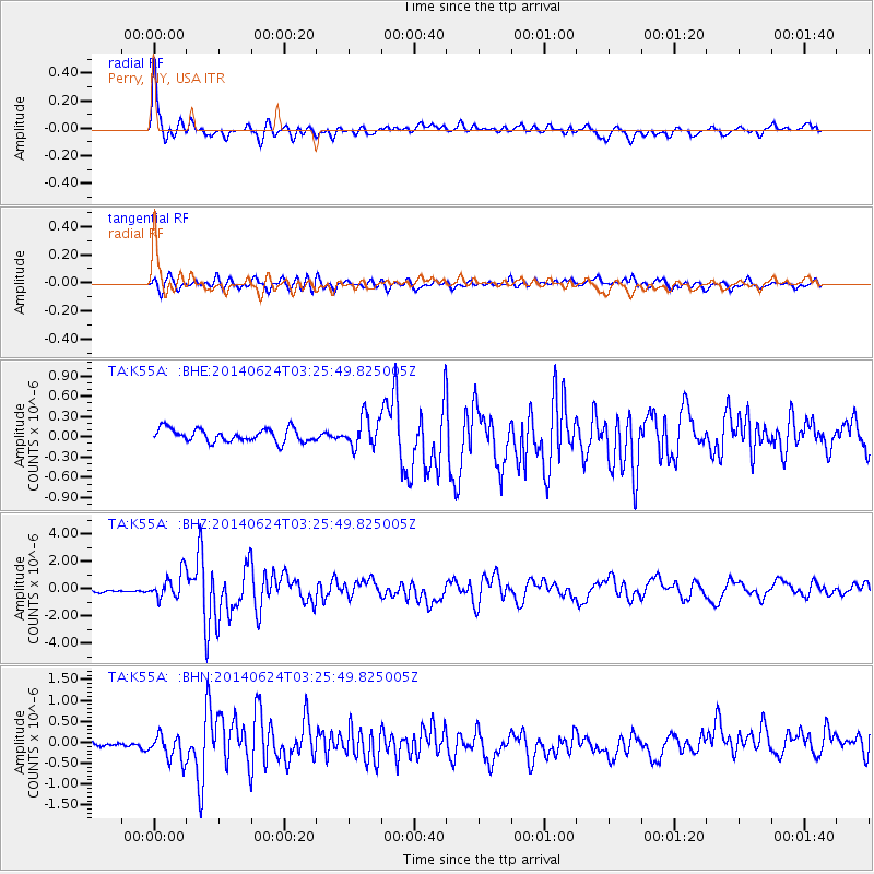
Earthquake location: Rat Islands, Aleutian Islands
Earthquake latitude/longitude: 52.3/176.7
Earthquake time(UTC): 2014/06/24 (175) 03:15:36 GMT
Earthquake Depth: 4.0 km
Earthquake Magnitude: 6.3 MWB, 5.7 ML, 6.4 MWC, 6.6 MI
Earthquake Catalog/Contributor: NEIC PDE/NEIC COMCAT
Network: TA USArray Transportable Network (new EarthScope stations)
Station: K55A Perry, NY, USA
Lat/Lon: 42.73 N/78.07 W
Elevation: 482 m
Distance: 65.5 deg
Az: 51.374 deg
Baz: 319.324 deg
Ray Param: 0.05822914
Estimated Moho Depth: 36.0 km
Estimated Crust Vp/Vs: 1.71
Assumed Crust Vp: 6.419 km/s
Estimated Crust Vs: 3.754 km/s
Estimated Crust Poisson's Ratio: 0.24
Radial Match: 88.01437 %
Radial Bump: 400
Transverse Match: 81.70974 %
Transverse Bump: 400
SOD ConfigId: 739768
Insert Time: 2014-07-08 04:15:15.838 +0000
GWidth: 2.5
Max Bumps: 400
Tol: 0.001

Signal To Noise

ChannelStoNSTALTA
TA:K55A: :BHZ:20140624T03:25:49.825005Z8.8320079.4170866E-71.06624526E-7
TA:K55A: :BHN:20140624T03:25:49.825005Z4.1417373.3595728E-78.111507E-8
TA:K55A: :BHE:20140624T03:25:49.825005Z2.32496712.244552E-79.654124E-8
Arrivals
Ps4.2 SECOND
PpPs15 SECOND
PsPs/PpSs19 SECOND