
L50A Kingsville, ON, CAN - Earthquake Result Viewer
| ||||||||||||||||||
| ||||||||||||||||||
| ||||||||||||||||||
|
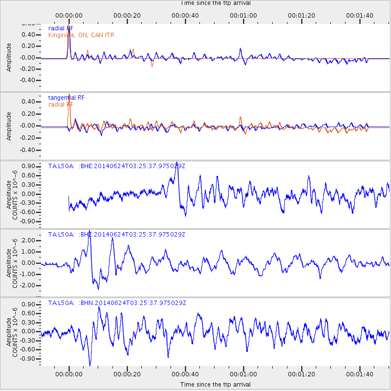
Signal To Noise
| Channel | StoN | STA | LTA |
| TA:L50A: :BHZ:20140624T03:25:37.975029Z | 4.7413526 | 5.3609887E-7 | 1.1306877E-7 |
| TA:L50A: :BHN:20140624T03:25:37.975029Z | 2.5390363 | 2.2562133E-7 | 8.8861015E-8 |
| TA:L50A: :BHE:20140624T03:25:37.975029Z | 1.8686936 | 3.120028E-7 | 1.6696308E-7 |
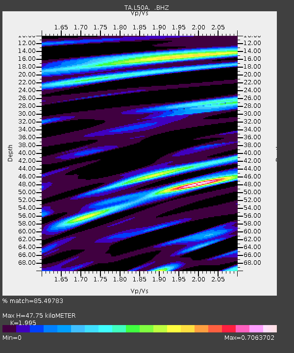
| Arrivals | |
| Ps | 7.6 SECOND |
| PpPs | 21 SECOND |
| PsPs/PpSs | 29 SECOND |

