L56A Greenwood, NY, USA - Earthquake Result Viewer
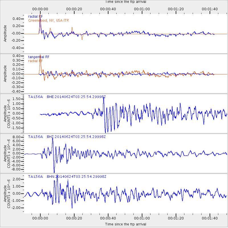
Earthquake location: Rat Islands, Aleutian Islands
Earthquake latitude/longitude: 52.3/176.7
Earthquake time(UTC): 2014/06/24 (175) 03:15:36 GMT
Earthquake Depth: 4.0 km
Earthquake Magnitude: 6.3 MWB, 5.7 ML, 6.4 MWC, 6.6 MI
Earthquake Catalog/Contributor: NEIC PDE/NEIC COMCAT
Network: TA USArray Transportable Network (new EarthScope stations)
Station: L56A Greenwood, NY, USA
Lat/Lon: 42.14 N/77.56 W
Elevation: 688 m
Distance: 66.2 deg
Az: 51.48 deg
Baz: 319.71 deg
Ray Param: 0.057773355
Estimated Moho Depth: 17.5 km
Estimated Crust Vp/Vs: 1.65
Assumed Crust Vp: 6.476 km/s
Estimated Crust Vs: 3.919 km/s
Estimated Crust Poisson's Ratio: 0.21
Radial Match: 87.82435 %
Radial Bump: 400
Transverse Match: 86.189064 %
Transverse Bump: 400
SOD ConfigId: 739768
Insert Time: 2014-07-08 04:16:00.416 +0000
GWidth: 2.5
Max Bumps: 400
Tol: 0.001

Signal To Noise

ChannelStoNSTALTA
TA:L56A: :BHZ:20140624T03:25:54.29998Z8.903511.398881E-61.5711566E-7
TA:L56A: :BHN:20140624T03:25:54.29998Z1.75258342.999825E-71.711659E-7
TA:L56A: :BHE:20140624T03:25:54.29998Z2.25314332.3853522E-71.05867755E-7
Arrivals
Ps1.8 SECOND
PpPs6.9 SECOND
PsPs/PpSs8.7 SECOND