
M52A Chesterland, OH, USA - Earthquake Result Viewer
| ||||||||||||||||||
| ||||||||||||||||||
| ||||||||||||||||||
|
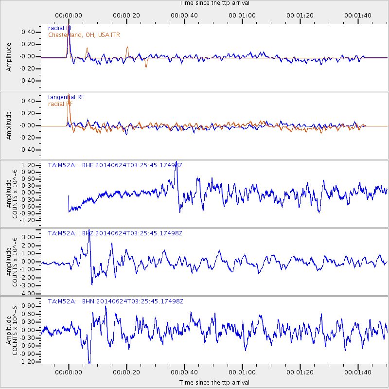
Signal To Noise
| Channel | StoN | STA | LTA |
| TA:M52A: :BHZ:20140624T03:25:45.17498Z | 3.9052896 | 6.677438E-7 | 1.7098445E-7 |
| TA:M52A: :BHN:20140624T03:25:45.17498Z | 1.859026 | 2.1947412E-7 | 1.18058665E-7 |
| TA:M52A: :BHE:20140624T03:25:45.17498Z | 1.5837947 | 3.9281133E-7 | 2.480191E-7 |
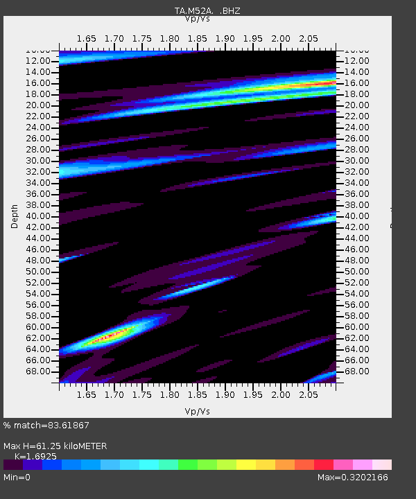
| Arrivals | |
| Ps | 6.8 SECOND |
| PpPs | 24 SECOND |
| PsPs/PpSs | 31 SECOND |

