You are here: Home > Network List > TA - USArray Transportable Network (new EarthScope stations) Stations List
> Station M53A WI Miller and Sons, Farmdale, OH, USA > Earthquake Result Viewer
M53A WI Miller and Sons, Farmdale, OH, USA - Earthquake Result Viewer

| Earthquake location: |
Rat Islands, Aleutian Islands |
| Earthquake latitude/longitude: |
52.3/176.7 |
| Earthquake time(UTC): |
2014/06/24 (175) 03:15:36 GMT |
| Earthquake Depth: |
4.0 km |
| Earthquake Magnitude: |
6.3 MWB, 5.7 ML, 6.4 MWC, 6.6 MI |
| Earthquake Catalog/Contributor: |
NEIC PDE/NEIC COMCAT |
|
| Network: |
TA USArray Transportable Network (new EarthScope stations) |
| Station: |
M53A WI Miller and Sons, Farmdale, OH, USA |
| Lat/Lon: |
41.44 N/80.68 W |
| Elevation: |
334 m |
|
| Distance: |
65.2 deg |
| Az: |
53.913 deg |
| Baz: |
318.642 deg |
| Ray Param: |
0.058427256 |
| Estimated Moho Depth: |
46.75 km |
| Estimated Crust Vp/Vs: |
2.02 |
| Assumed Crust Vp: |
6.483 km/s |
| Estimated Crust Vs: |
3.217 km/s |
| Estimated Crust Poisson's Ratio: |
0.34 |
|
| Radial Match: |
89.18817 % |
| Radial Bump: |
372 |
| Transverse Match: |
64.19154 % |
| Transverse Bump: |
400 |
| SOD ConfigId: |
739768 |
| Insert Time: |
2014-07-08 04:16:37.183 +0000 |
| GWidth: |
2.5 |
| Max Bumps: |
400 |
| Tol: |
0.001 |
|
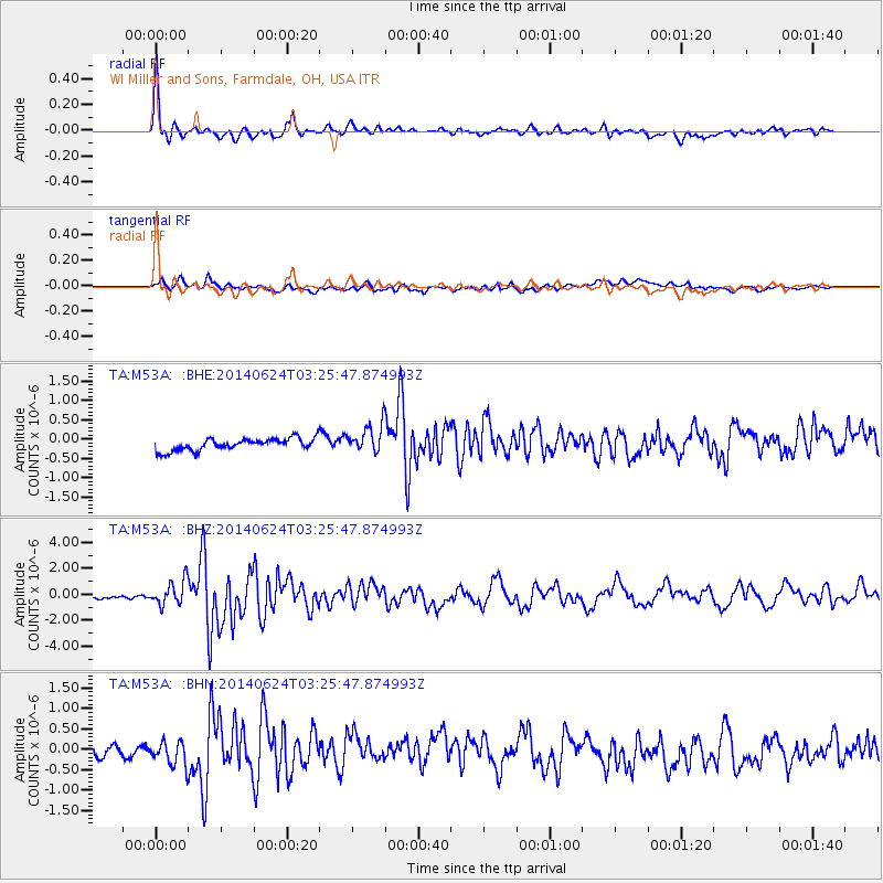
Signal To Noise
| Channel | StoN | STA | LTA |
| TA:M53A: :BHZ:20140624T03:25:47.874993Z | 5.27298 | 9.307037E-7 | 1.7650432E-7 |
| TA:M53A: :BHN:20140624T03:25:47.874993Z | 2.3243468 | 2.825446E-7 | 1.2155871E-7 |
| TA:M53A: :BHE:20140624T03:25:47.874993Z | 2.344204 | 3.618152E-7 | 1.5434459E-7 |
| Arrivals |
| Ps | 7.6 SECOND |
| PpPs | 21 SECOND |
| PsPs/PpSs | 29 SECOND |


