You are here: Home > Network List > II - Global Seismograph Network (GSN - IRIS/IDA) Stations List
> Station WRAB Tennant Creek, NT, Australia > Earthquake Result Viewer
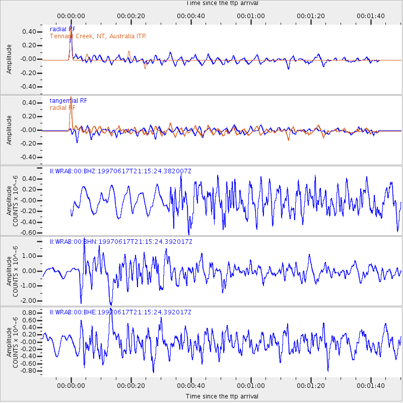
WRAB Tennant Creek, NT, Australia - Earthquake Result Viewer
*The percent match for this event was below the threshold and hence no stack was calculated.
| Earthquake location: |
Andreanof Islands, Aleutian Is. |
| Earthquake latitude/longitude: |
51.3/-179.3 |
| Earthquake time(UTC): |
1997/06/17 (168) 21:03:40 GMT |
| Earthquake Depth: |
33 km |
| Earthquake Magnitude: |
6.4 MB, 6.3 MS, 6.4 UNKNOWN, 6.6 ML |
| Earthquake Catalog/Contributor: |
WHDF/NEIC |
|
| Network: |
II Global Seismograph Network (GSN - IRIS/IDA) |
| Station: |
WRAB Tennant Creek, NT, Australia |
| Lat/Lon: |
19.93 S/134.36 E |
| Elevation: |
366 m |
|
| Distance: |
81.7 deg |
| Az: |
223.424 deg |
| Baz: |
27.273 deg |
| Ray Param: |
$rayparam |
*The percent match for this event was below the threshold and hence was not used in the summary stack. |
|
| Radial Match: |
72.31727 % |
| Radial Bump: |
400 |
| Transverse Match: |
63.70328 % |
| Transverse Bump: |
400 |
| SOD ConfigId: |
4480 |
| Insert Time: |
2010-03-01 23:31:55.183 +0000 |
| GWidth: |
2.5 |
| Max Bumps: |
400 |
| Tol: |
0.001 |
|
Signal To Noise
| Channel | StoN | STA | LTA |
| II:WRAB:00:BHN:19970617T21:15:24.392017Z | 4.4754386 | 8.207881E-7 | 1.8339836E-7 |
| II:WRAB:00:BHE:19970617T21:15:24.392017Z | 1.7247945 | 3.0225283E-7 | 1.752399E-7 |
| II:WRAB:00:BHZ:19970617T21:15:24.382007Z | 1.0093862 | 1.6618803E-7 | 1.6464266E-7 |
| Arrivals |
| Ps | |
| PpPs | |
| PsPs/PpSs | |


