P51A Williamsport, OH, USA - Earthquake Result Viewer
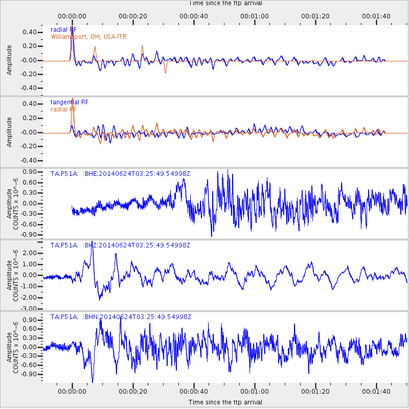
Earthquake location: Rat Islands, Aleutian Islands
Earthquake latitude/longitude: 52.3/176.7
Earthquake time(UTC): 2014/06/24 (175) 03:15:36 GMT
Earthquake Depth: 4.0 km
Earthquake Magnitude: 6.3 MWB, 5.7 ML, 6.4 MWC, 6.6 MI
Earthquake Catalog/Contributor: NEIC PDE/NEIC COMCAT
Network: TA USArray Transportable Network (new EarthScope stations)
Station: P51A Williamsport, OH, USA
Lat/Lon: 39.48 N/83.06 W
Elevation: 211 m
Distance: 65.5 deg
Az: 56.839 deg
Baz: 318.32 deg
Ray Param: 0.058258068
Estimated Moho Depth: 69.25 km
Estimated Crust Vp/Vs: 1.61
Assumed Crust Vp: 6.232 km/s
Estimated Crust Vs: 3.871 km/s
Estimated Crust Poisson's Ratio: 0.19
Radial Match: 83.53511 %
Radial Bump: 400
Transverse Match: 60.835495 %
Transverse Bump: 400
SOD ConfigId: 739768
Insert Time: 2014-07-08 04:19:32.562 +0000
GWidth: 2.5
Max Bumps: 400
Tol: 0.001

Signal To Noise

ChannelStoNSTALTA
TA:P51A: :BHZ:20140624T03:25:49.54998Z3.23318585.7215937E-71.7696458E-7
TA:P51A: :BHN:20140624T03:25:49.54998Z1.83606422.4315736E-71.3243402E-7
TA:P51A: :BHE:20140624T03:25:49.54998Z2.30160262.6558197E-71.1539003E-7
Arrivals
Ps7.1 SECOND
PpPs28 SECOND
PsPs/PpSs35 SECOND