
P53A Whipple, OH, USA - Earthquake Result Viewer
| ||||||||||||||||||
| ||||||||||||||||||
| ||||||||||||||||||
|
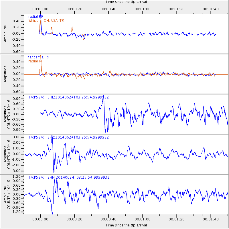
Signal To Noise
| Channel | StoN | STA | LTA |
| TA:P53A: :BHZ:20140624T03:25:54.999993Z | 5.910532 | 6.919048E-7 | 1.1706303E-7 |
| TA:P53A: :BHN:20140624T03:25:54.999993Z | 2.1237595 | 2.149028E-7 | 1.01189805E-7 |
| TA:P53A: :BHE:20140624T03:25:54.999993Z | 1.6632237 | 1.7084407E-7 | 1.0271864E-7 |
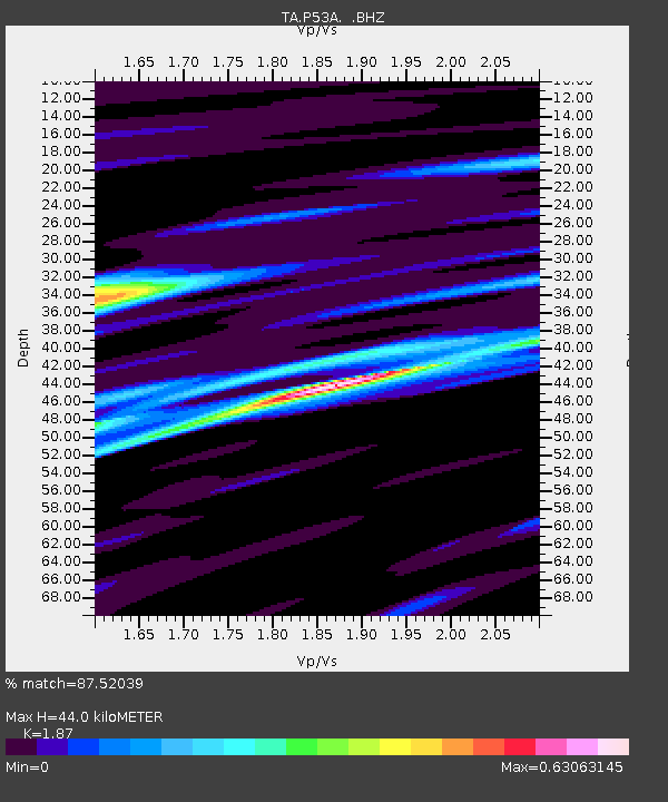
| Arrivals | |
| Ps | 6.4 SECOND |
| PpPs | 20 SECOND |
| PsPs/PpSs | 26 SECOND |

