You are here: Home > Network List > II - Global Seismograph Network (GSN - IRIS/IDA) Stations List
> Station WRAB Tennant Creek, NT, Australia > Earthquake Result Viewer
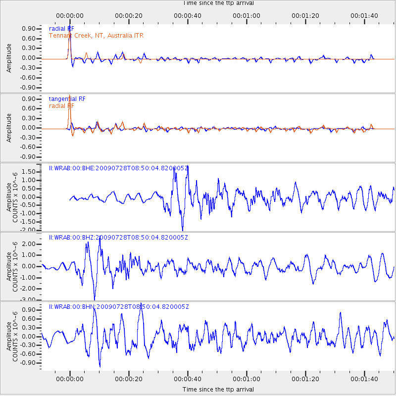
WRAB Tennant Creek, NT, Australia - Earthquake Result Viewer
*The percent match for this event was below the threshold and hence no stack was calculated.
| Earthquake location: |
Southwest Of Sumatra, Indonesia |
| Earthquake latitude/longitude: |
-5.5/101.7 |
| Earthquake time(UTC): |
2009/07/28 (209) 08:43:44 GMT |
| Earthquake Depth: |
10 km |
| Earthquake Magnitude: |
5.6 MB, 5.5 MS, 5.6 MW, 5.6 MW |
| Earthquake Catalog/Contributor: |
WHDF/NEIC |
|
| Network: |
II Global Seismograph Network (GSN - IRIS/IDA) |
| Station: |
WRAB Tennant Creek, NT, Australia |
| Lat/Lon: |
19.93 S/134.36 E |
| Elevation: |
366 m |
|
| Distance: |
34.8 deg |
| Az: |
117.286 deg |
| Baz: |
289.891 deg |
| Ray Param: |
$rayparam |
*The percent match for this event was below the threshold and hence was not used in the summary stack. |
|
| Radial Match: |
78.8776 % |
| Radial Bump: |
290 |
| Transverse Match: |
65.3417 % |
| Transverse Bump: |
400 |
| SOD ConfigId: |
2648 |
| Insert Time: |
2010-03-01 23:32:08.552 +0000 |
| GWidth: |
2.5 |
| Max Bumps: |
400 |
| Tol: |
0.001 |
|
Signal To Noise
| Channel | StoN | STA | LTA |
| II:WRAB:00:BHZ:20090728T08:50:04.820005Z | 3.6079483 | 6.1202866E-7 | 1.6963344E-7 |
| II:WRAB:00:BHN:20090728T08:50:04.820005Z | 1.1245952 | 1.9926397E-7 | 1.7718729E-7 |
| II:WRAB:00:BHE:20090728T08:50:04.820005Z | 2.8481452 | 4.7141765E-7 | 1.6551742E-7 |
| Arrivals |
| Ps | |
| PpPs | |
| PsPs/PpSs | |


