Q24A Divide, CO, USA - Earthquake Result Viewer
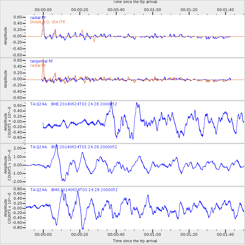
Earthquake location: Rat Islands, Aleutian Islands
Earthquake latitude/longitude: 52.3/176.7
Earthquake time(UTC): 2014/06/24 (175) 03:15:36 GMT
Earthquake Depth: 4.0 km
Earthquake Magnitude: 6.3 MWB, 5.7 ML, 6.4 MWC, 6.6 MI
Earthquake Catalog/Contributor: NEIC PDE/NEIC COMCAT
Network: TA USArray Transportable Network (new EarthScope stations)
Station: Q24A Divide, CO, USA
Lat/Lon: 38.96 N/105.15 W
Elevation: 2775 m
Distance: 53.7 deg
Az: 71.277 deg
Baz: 311.684 deg
Ray Param: 0.06596233
Estimated Moho Depth: 37.25 km
Estimated Crust Vp/Vs: 1.93
Assumed Crust Vp: 6.159 km/s
Estimated Crust Vs: 3.187 km/s
Estimated Crust Poisson's Ratio: 0.32
Radial Match: 93.537605 %
Radial Bump: 400
Transverse Match: 75.87541 %
Transverse Bump: 400
SOD ConfigId: 739768
Insert Time: 2014-07-08 04:20:13.447 +0000
GWidth: 2.5
Max Bumps: 400
Tol: 0.001

Signal To Noise

ChannelStoNSTALTA
TA:Q24A: :BHZ:20140624T03:24:28.200005Z2.26428582.3420321E-71.03433585E-7
TA:Q24A: :BHN:20140624T03:24:28.200005Z1.4752691.4555667E-79.86645E-8
TA:Q24A: :BHE:20140624T03:24:28.200005Z1.44911861.1773673E-78.124714E-8
Arrivals
Ps5.9 SECOND
PpPs17 SECOND
PsPs/PpSs23 SECOND