Q54A Coxs Mills, WV, USA - Earthquake Result Viewer
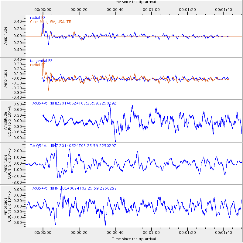
Earthquake location: Rat Islands, Aleutian Islands
Earthquake latitude/longitude: 52.3/176.7
Earthquake time(UTC): 2014/06/24 (175) 03:15:36 GMT
Earthquake Depth: 4.0 km
Earthquake Magnitude: 6.3 MWB, 5.7 ML, 6.4 MWC, 6.6 MI
Earthquake Catalog/Contributor: NEIC PDE/NEIC COMCAT
Network: TA USArray Transportable Network (new EarthScope stations)
Station: Q54A Coxs Mills, WV, USA
Lat/Lon: 38.98 N/80.83 W
Elevation: 254 m
Distance: 67.0 deg
Az: 55.775 deg
Baz: 319.294 deg
Ray Param: 0.057260826
Estimated Moho Depth: 44.25 km
Estimated Crust Vp/Vs: 1.62
Assumed Crust Vp: 6.207 km/s
Estimated Crust Vs: 3.82 km/s
Estimated Crust Poisson's Ratio: 0.20
Radial Match: 83.44292 %
Radial Bump: 400
Transverse Match: 75.769615 %
Transverse Bump: 400
SOD ConfigId: 739768
Insert Time: 2014-07-08 04:20:28.064 +0000
GWidth: 2.5
Max Bumps: 400
Tol: 0.001

Signal To Noise

ChannelStoNSTALTA
TA:Q54A: :BHZ:20140624T03:25:59.225029Z4.62480976.566738E-71.4198937E-7
TA:Q54A: :BHN:20140624T03:25:59.225029Z1.76077562.3910263E-71.3579394E-7
TA:Q54A: :BHE:20140624T03:25:59.225029Z1.2061681.7824739E-71.477799E-7
Arrivals
Ps4.6 SECOND
PpPs18 SECOND
PsPs/PpSs23 SECOND