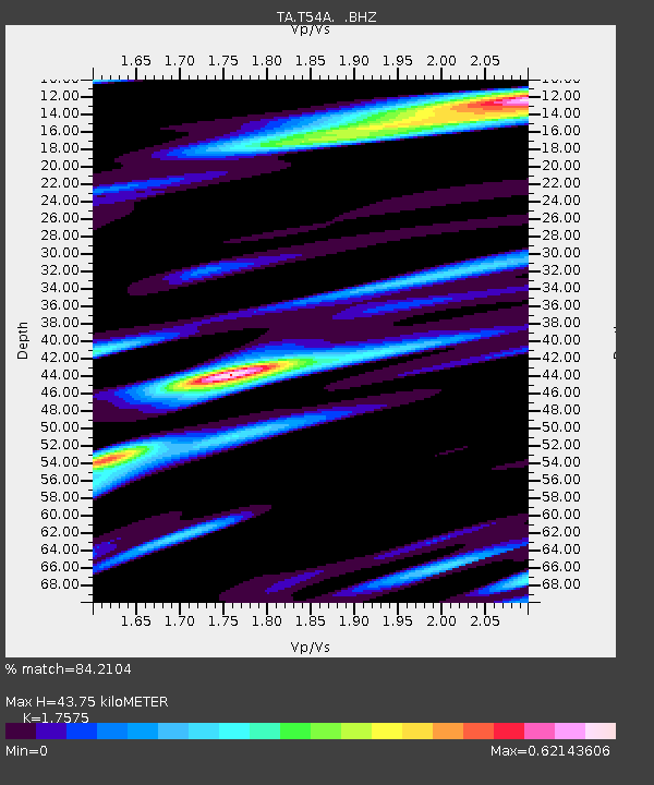
T54A Tazewell, VA, USA - Earthquake Result Viewer
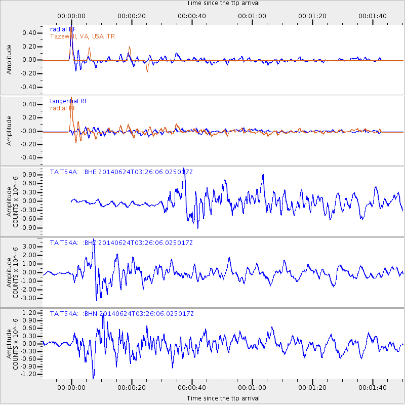
Earthquake location: Rat Islands, Aleutian Islands
Earthquake latitude/longitude: 52.3/176.7
Earthquake time(UTC): 2014/06/24 (175) 03:15:36 GMT
Earthquake Depth: 4.0 km
Earthquake Magnitude: 6.3 MWB, 5.7 ML, 6.4 MWC, 6.6 MI
Earthquake Catalog/Contributor: NEIC PDE/NEIC COMCAT
Network: TA USArray Transportable Network (new EarthScope stations)
Station: T54A Tazewell, VA, USA
Lat/Lon: 37.06 N/81.58 W
Elevation: 852 m
Distance: 68.1 deg
Az: 57.608 deg
Baz: 319.539 deg
Ray Param: 0.056557976
Estimated Moho Depth: 43.75 km
Estimated Crust Vp/Vs: 1.76
Assumed Crust Vp: 6.159 km/s
Estimated Crust Vs: 3.504 km/s
Estimated Crust Poisson's Ratio: 0.26
Radial Match: 84.2104 %
Radial Bump: 400
Transverse Match: 71.03284 %
Transverse Bump: 400
SOD ConfigId: 739768
Insert Time: 2014-07-08 04:22:04.093 +0000
GWidth: 2.5
Max Bumps: 400
Tol: 0.001

Signal To Noise

ChannelStoNSTALTA
TA:T54A: :BHZ:20140624T03:26:06.025017Z6.3797296.7705787E-71.0612643E-7
TA:T54A: :BHN:20140624T03:26:06.025017Z1.72685922.6059075E-71.5090444E-7
TA:T54A: :BHE:20140624T03:26:06.025017Z2.94745831.9407769E-76.584578E-8
Arrivals
Ps5.6 SECOND
PpPs19 SECOND
PsPs/PpSs24 SECOND