
T55A Pulaski, VA, USA - Earthquake Result Viewer
| ||||||||||||||||||
| ||||||||||||||||||
| ||||||||||||||||||
|

Signal To Noise
| Channel | StoN | STA | LTA |
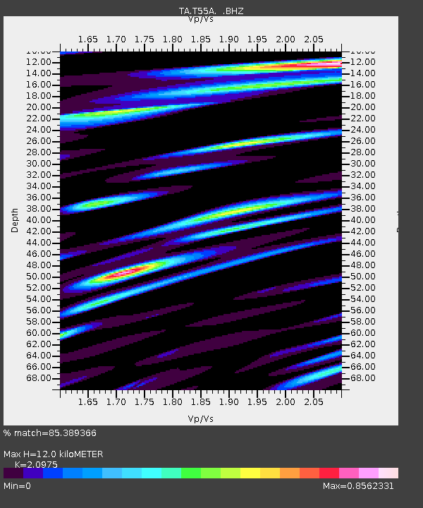
| TA:T55A: :BHZ:20140624T03:26:08.29998Z | 4.219815 | 6.43304E-7 | 1.5244841E-7 |
| TA:T55A: :BHN:20140624T03:26:08.29998Z | 1.4503541 | 2.0923397E-7 | 1.4426406E-7 |
| TA:T55A: :BHE:20140624T03:26:08.29998Z | 2.1506047 | 2.1256847E-7 | 9.8841255E-8 |
| Arrivals | |
| Ps | 2.2 SECOND |
| PpPs | 5.9 SECOND |
| PsPs/PpSs | 8.1 SECOND |

