You are here: Home > Network List > II - Global Seismograph Network (GSN - IRIS/IDA) Stations List
> Station WRAB Tennant Creek, NT, Australia > Earthquake Result Viewer
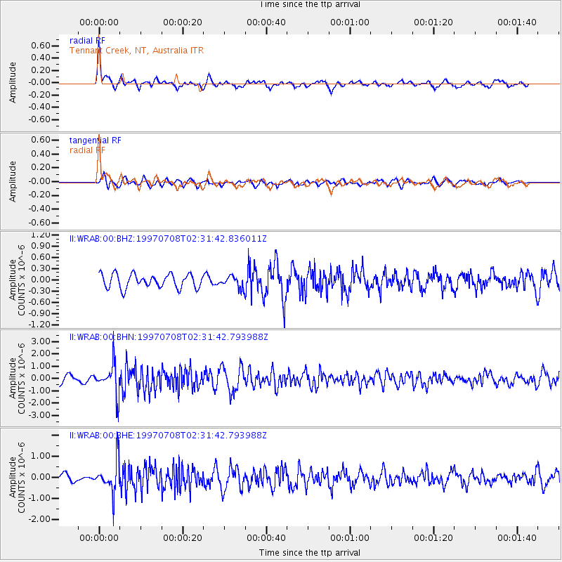
WRAB Tennant Creek, NT, Australia - Earthquake Result Viewer
*The percent match for this event was below the threshold and hence no stack was calculated.
| Earthquake location: |
Volcano Islands, Japan Region |
| Earthquake latitude/longitude: |
23.8/142.7 |
| Earthquake time(UTC): |
1997/07/08 (189) 02:24:07 GMT |
| Earthquake Depth: |
33 km |
| Earthquake Magnitude: |
5.8 MB, 5.6 MS, 5.9 UNKNOWN, 5.8 MW |
| Earthquake Catalog/Contributor: |
WHDF/NEIC |
|
| Network: |
II Global Seismograph Network (GSN - IRIS/IDA) |
| Station: |
WRAB Tennant Creek, NT, Australia |
| Lat/Lon: |
19.93 S/134.36 E |
| Elevation: |
366 m |
|
| Distance: |
44.2 deg |
| Az: |
191.278 deg |
| Baz: |
10.976 deg |
| Ray Param: |
$rayparam |
*The percent match for this event was below the threshold and hence was not used in the summary stack. |
|
| Radial Match: |
78.890366 % |
| Radial Bump: |
400 |
| Transverse Match: |
55.23265 % |
| Transverse Bump: |
400 |
| SOD ConfigId: |
4480 |
| Insert Time: |
2010-03-01 23:32:16.044 +0000 |
| GWidth: |
2.5 |
| Max Bumps: |
400 |
| Tol: |
0.001 |
|
Signal To Noise
| Channel | StoN | STA | LTA |
| II:WRAB:00:BHN:19970708T02:31:42.793988Z | 4.230858 | 1.2529641E-6 | 2.9614895E-7 |
| II:WRAB:00:BHE:19970708T02:31:42.793988Z | 3.9067605 | 7.7396436E-7 | 1.9810899E-7 |
| II:WRAB:00:BHZ:19970708T02:31:42.836011Z | 0.8449782 | 1.5638204E-7 | 1.8507227E-7 |
| Arrivals |
| Ps | |
| PpPs | |
| PsPs/PpSs | |


